|
search place name
|
||
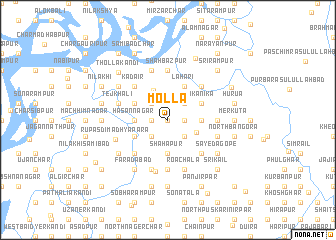
Molla (Barisāl, Bangladesh)Molla is a town in the Barisāl region of Bangladesh. An overview map of the region around Molla is displayed below.
regional and 3d topo map of Molla, Bangladesh ::
Molla airports ::
The nearest airport is IXA - Agartala, located 34.4 km east of Molla.
Other airports nearby include DAC - Dhaka Zia Intl (53.1 km west), IXH - Kailashahar (124.4 km north east), ZYL - Sylhet Osmani Osmany Intl (160.9 km north east), JSR - Jessore (191.9 km west), Nearby towns ::
Khāgātua (0.0km north) //
Jasātua (1.7km east) //
Mājhiāra (1.7km west) //
Perākāndi (1.7km west) //
North Dārara (2.5km north east) //
Rasūlābād (2.5km north east) //
Bāldibāri (2.5km south east) //
Ratanpura (2.5km south east) //
Bāuchāil (2.5km south east) //
Noāgaon (2.5km north west) //
Jalli (2.5km north west) //
Bānia Chāng (2.5km north west) //
Digsāir (2.5km north west) //
Dāmla (2.5km south west) //
Sātmura (3.3km south east) //
Syamgaon (3.6km north west) //
Chaturangakhola (3.7km south) //
Shāhāpur (3.7km south) //
Chelikhola (3.4km east) //
Hāsannagar (3.4km west) //
Char Bādda (3.4km west) //
Darikāndi (3.4km west) //
Lahari (4.1km north east) //
Kālghara (4.1km north east) //
Sikānika (3.9km north east) //
Sonātala (3.9km north west) //
Banda Bāhir Char (3.9km north west) //
Kāzirgaon (3.9km north west) //
Bādda (3.9km north west) //
[all distances 'as the bird flies' and approximate] 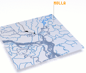 Places with similar names to Molla, Bangladesh ::
Disclaimer :: Information on this page comes without warranty of any kind |
||
|
Where is Molla? Elevation and coordinates ::
Latitude (lat): 23°48'0"N Longitude (lon): 90°55'0"E
Elevation (approx.): 7m (map arrows pan, magnifying glasses zoom) |
||
|
Visiting Molla? Hotel/Accommodation ::
Book a hotel in Molla Travel Guide ::
Buy a travel guide for Bangladesh rental cars ::
car rental offers GPS waypoint ::
download a GPX waypoint (PoI) of Molla for your GPS receiver
|
||