|
search place name
|
||
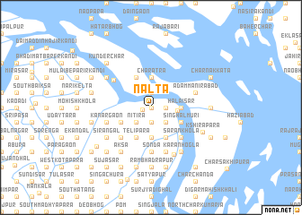
Nalta (Barisāl, Bangladesh)Nalta is a town in the Barisāl region of Bangladesh. An overview map of the region around Nalta is displayed below.
regional and 3d topo map of Nalta, Bangladesh ::
Nalta airports ::
The nearest airport is DAC - Dhaka Zia Intl, located 60.4 km north of Nalta.
Other airports nearby include IXA - Agartala (103.6 km north east), JSR - Jessore (132.6 km west), IRD - Ishurdi (171.2 km north west), CGP - Chittagong Shah Amanat Intl (182.0 km south east), Nearby towns ::
Kedārpur (0.0km north) //
Pānchgaon (0.0km north) //
Gorāgaon (0.0km north) //
Kalukāti (1.0km west) //
Sureswar (1.9km north) //
Goālbāthān (1.7km east) //
Mānākhān (1.9km south) //
Ichhāpāra (1.7km east) //
Pātdal (1.9km south) //
Uttarpāra (2.5km south east) //
Nitira (2.5km south west) //
Ātpāra (2.5km south east) //
Bhitar Kusia (2.5km south east) //
Rāhāpāra (2.5km south east) //
Chākdha (2.5km south west) //
Nandansār (3.1km east) //
Hālaisār (3.4km east) //
Char Lāulāni (3.4km east) //
Char Ātra (3.7km north) //
Sāldha (3.7km south) //
Bārāipāra (3.9km south east) //
Singhalmuri (3.9km south east) //
Basār Char (4.1km north west) //
Telipāra (4.1km south west) //
Panditsar (4.1km south east) //
Bhumkhāra (4.1km south west) //
Deojuri (4.1km south west) //
Dakshinpāra (4.1km south east) //
Bāhir Kusia (4.1km south east) //
[all distances 'as the bird flies' and approximate] 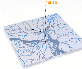 Places with similar names to Nalta, Bangladesh ::
Disclaimer :: Information on this page comes without warranty of any kind |
||
|
Where is Nalta? Elevation and coordinates ::
Latitude (lat): 23°18'0"N Longitude (lon): 90°27'0"E
Elevation (approx.): 4m (map arrows pan, magnifying glasses zoom) |
||
|
Visiting Nalta? Hotel/Accommodation ::
Book a hotel in Nalta Travel Guide ::
Buy a travel guide for Bangladesh rental cars ::
car rental offers GPS waypoint ::
download a GPX waypoint (PoI) of Nalta for your GPS receiver
|
||