|
search place name
|
||
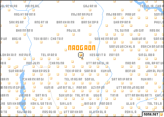
Naogaon (Barisāl, Bangladesh)Naogaon is a town in the Barisāl region of Bangladesh. An overview map of the region around Naogaon is displayed below.
regional and 3d topo map of Naogaon, Bangladesh ::
Naogaon airports ::
The nearest airport is DAC - Dhaka Zia Intl, located 18.1 km south of Naogaon.
Other airports nearby include IXA - Agartala (81.4 km east), IRD - Ishurdi (143.4 km west), JSR - Jessore (159.6 km south west), IXH - Kailashahar (161.9 km east), Nearby towns ::
Jamuna (0.0km north) //
Dakshin Dighādia (0.0km north) //
Dari Baldha (1.9km south) //
Khundia (1.9km north) //
Bāluchākuli (1.9km south) //
Jaydebpur (2.1km west) //
Bhora (2.5km south west) //
Lāgālia (2.5km south west) //
Pārāgaon (2.5km south east) //
Kālni (2.5km south east) //
Baldha (2.5km south east) //
Hārināl (2.5km south west) //
Bāngālgāchh (2.5km south west) //
Kesarita (3.4km east) //
Kānāia (3.7km south) //
Pākuria (3.9km south east) //
Ārgaria (3.9km south east) //
Rosādia (3.9km south east) //
Uttar Daulia (3.9km south east) //
Chilani (3.9km south east) //
Āturi (3.9km south east) //
Nāsārān (4.1km south east) //
Nilerpāra (4.1km south west) //
Bhārārul (4.1km south west) //
Tekipāra (4.1km south west) //
Ādābai (4.1km south west) //
Nimuria (4.1km north east) //
Sārāia (4.1km south east) //
Dakshin Sālna (3.9km north west) //
[all distances 'as the bird flies' and approximate] 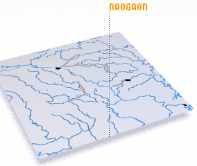 Places with similar names to Naogaon, Bangladesh ::
Disclaimer :: Information on this page comes without warranty of any kind |
||
|
Where is Naogaon? Elevation and coordinates ::
Latitude (lat): 24°0'0"N Longitude (lon): 90°27'0"E
Elevation (approx.): 7m (map arrows pan, magnifying glasses zoom) |
||
|
Visiting Naogaon? Hotel/Accommodation ::
Book a hotel in Naogaon Travel Guide ::
Buy a travel guide for Bangladesh rental cars ::
car rental offers GPS waypoint ::
download a GPX waypoint (PoI) of Naogaon for your GPS receiver
|
||