|
search place name
|
||
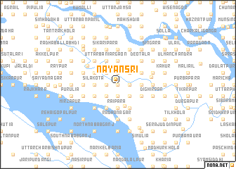
Nayansri (Barisāl, Bangladesh)Nayansri is a town in the Barisāl region of Bangladesh. An overview map of the region around Nayansri is displayed below.
regional and 3d topo map of Nayansri, Bangladesh ::
Nayansri airports ::
The nearest airport is DAC - Dhaka Zia Intl, located 35.8 km north east of Nayansri.
Other airports nearby include JSR - Jessore (110.5 km south west), IXA - Agartala (117.5 km east), IRD - Ishurdi (122.1 km north west), RJH - Rajshahi Shah Mokhdum (175.7 km north west), Nearby towns ::
Hasnābād (0.0km north) //
Purātan Bāndura (0.0km north) //
Patkārkānda (1.7km east) //
Imāmnagar (1.7km east) //
Sādāpur (1.7km east) //
Mahabbatpur (1.7km east) //
Mājhirkānda (1.7km east) //
Āhlādipur (1.7km east) //
Chhota Ekrasi (1.9km south) //
Kānthālighāta (1.9km south) //
Purba Saitānkāti (1.9km north) //
Rāri Sailla (1.9km north) //
Sāpleja (1.9km north) //
Munshinagar (1.7km west) //
Ghiāria (1.9km north) //
Golla (1.9km north) //
Lālsri (1.9km north) //
Puākāir (1.7km west) //
Saiyadpur (2.5km south east) //
Mridhārkānda (2.5km south east) //
Hazratpur (2.5km south east) //
Khāliārbhita (2.5km south east) //
Khālpār (2.5km south east) //
Bara Hānrikānda (2.5km south east) //
Māmundi (2.5km north east) //
Bara Nabagrām (2.5km north east) //
Raghudebpur (2.5km south west) //
Māhātābnagar (2.5km south west) //
Ārita (2.5km south west) //
[all distances 'as the bird flies' and approximate]  Places with similar names to Nayansri, Bangladesh ::
// Nāyūnsāri (IN)
Disclaimer :: Information on this page comes without warranty of any kind |
||
|
Where is Nayansri? Elevation and coordinates ::
Latitude (lat): 23°39'0"N Longitude (lon): 90°7'0"E
Elevation (approx.): 6m (map arrows pan, magnifying glasses zoom) |
||
|
Visiting Nayansri? Hotel/Accommodation ::
Book a hotel in Nayansri Travel Guide ::
Buy a travel guide for Bangladesh rental cars ::
car rental offers GPS waypoint ::
download a GPX waypoint (PoI) of Nayansri for your GPS receiver
|
||