|
search place name
|
||
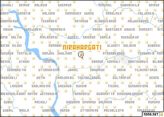
Nirāhārgāti (Barisāl, Bangladesh)Nirāhārgāti is a town in the Barisāl region of Bangladesh. An overview map of the region around Nirāhārgāti is displayed below.
regional and 3d topo map of Nirāhārgāti, Bangladesh ::
Nirāhārgāti airports ::
The nearest airport is DAC - Dhaka Zia Intl, located 71.5 km south west of Nirāhārgāti.
Other airports nearby include IXA - Agartala (82.9 km south east), ZYL - Sylhet Osmani Osmany Intl (133.4 km north east), IXH - Kailashahar (135.0 km east), IRD - Ishurdi (168.8 km west), Nearby towns ::
Ātira (0.0km north) //
Bil Chātal (0.0km north) //
Nāndānia (0.0km north) //
Barsikura (1.9km south) //
Dhuljuri (1.9km south) //
Nārāyandahar (1.9km south) //
Ārāibāria (1.7km west) //
Sidhla (1.7km west) //
Ganamān Purura (1.9km north) //
Kāpāsātia (1.9km north) //
Ānuha (1.9km north) //
Naipurura (1.9km north) //
Luli Kāndi (1.9km north) //
Jagdal (1.7km east) //
Pumdi (1.7km east) //
Dhekia (2.5km south west) //
Husainpur (2.5km south west) //
Sāhedal (2.5km south east) //
Char Pumdi (2.5km south east) //
Dāhara (2.5km south east) //
Mādhakhola (2.5km north west) //
Rānāgaon (2.5km north east) //
Kesera (2.5km north east) //
Harischandra Patti (2.5km north east) //
Tegharia (2.5km north east) //
Dhulihar (3.4km west) //
Dhankura (3.7km south) //
Bir Pāiksa (3.7km south) //
Kurimāra (3.7km south) //
[all distances 'as the bird flies' and approximate] 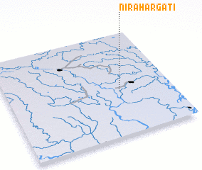 Places with similar names to Nirāhārgāti, Bangladesh ::
// Naraharikāti (BD)
Disclaimer :: Information on this page comes without warranty of any kind |
||
|
Where is Nirāhārgāti? Elevation and coordinates ::
Latitude (lat): 24°26'0"N Longitude (lon): 90°41'0"E
Elevation (approx.): 13m (map arrows pan, magnifying glasses zoom) |
||
|
Visiting Nirāhārgāti? Hotel/Accommodation ::
Book a hotel in Nirāhārgāti Travel Guide ::
Buy a travel guide for Bangladesh rental cars ::
car rental offers GPS waypoint ::
download a GPX waypoint (PoI) of Nirāhārgāti for your GPS receiver
|
||