|
search place name
|
||
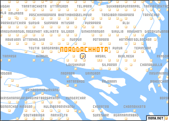
Noadda Chhota (Barisāl, Bangladesh)Noadda Chhota is a town in the Barisāl region of Bangladesh. An overview map of the region around Noadda Chhota is displayed below.
regional and 3d topo map of Noadda Chhota, Bangladesh ::
Noadda Chhota airports ::
The nearest airport is DAC - Dhaka Zia Intl, located 45.4 km north of Noadda Chhota.
Other airports nearby include IXA - Agartala (97.9 km north east), JSR - Jessore (131.4 km west), IRD - Ishurdi (160.5 km north west), IXH - Kailashahar (188.8 km north east), Nearby towns ::
Pāchan Khola (0.0km north) //
Bānāri (0.0km north) //
Marichādi (1.7km west) //
Bāshira (1.9km north) //
Kalma (1.9km north) //
Dhāidia (2.4km north west) //
Dhalchhatra (2.5km south east) //
Lakshmipur (2.5km south west) //
Chitrakara (2.5km north east) //
Bānkāij (2.5km north east) //
Dasottar (2.5km north east) //
Jogānia (2.5km north east) //
Gora Kānda (2.5km north west) //
Dahari (2.5km north west) //
Bharākar (2.5km north west) //
Gārurgaon (2.9km east) //
Hāsāil (3.4km east) //
Barāil (3.4km east) //
Kalikāl (3.4km west) //
Pātali (3.4km west) //
Bhātnisār (3.7km north) //
Ārial (3.7km north) //
Daingaon (4.1km south east) //
Saulparan (3.9km south east) //
Pānchgaon (3.9km north east) //
Kukrādi (3.9km north east) //
Khalāgaon (3.9km north east) //
Rānādia (3.9km north west) //
Pākhidia (3.9km north west) //
[all distances 'as the bird flies' and approximate] 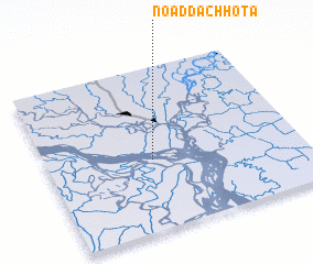 Places with similar names to Noadda Chhota, Bangladesh ::
// Natchut (MM)
// Now Dasht (IR)
// N'daichet (MM)
// Ntchiado (TG)
// Neatishead (GB)
// Hnatchodaw (MM)
Disclaimer :: Information on this page comes without warranty of any kind |
||
|
Where is Noadda Chhota? Elevation and coordinates ::
Latitude (lat): 23°26'0"N Longitude (lon): 90°25'0"E
(map arrows pan, magnifying glasses zoom) |
||
|
Visiting Noadda Chhota? Hotel/Accommodation ::
Book a hotel in Noadda Chhota Travel Guide ::
Buy a travel guide for Bangladesh rental cars ::
car rental offers GPS waypoint ::
download a GPX waypoint (PoI) of Noadda Chhota for your GPS receiver
|
||