|
search place name
|
||
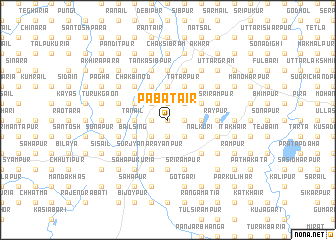
Pabātair (Barisāl, Bangladesh)Pabātair is a town in the Barisāl region of Bangladesh. An overview map of the region around Pabātair is displayed below.
regional and 3d topo map of Pabātair, Bangladesh ::
Pabātair airports ::
The nearest airport is RJH - Rajshahi Shah Mokhdum, located 45.4 km south of Pabātair.
Other airports nearby include IRD - Ishurdi (81.9 km south east), SPD - Saidpur (104.1 km north), COH - Cooch-behar Cooch Behar (181.5 km north east), JSR - Jessore (187.8 km south), Nearby towns ::
Iswar Lakshmīpur (0.0km north) //
Ghāsiāra (0.0km north) //
Dakshin Lakshmīpur (0.0km north) //
Kachukuri (0.0km north) //
Bānsbaria (0.0km north) //
Srīnagar (1.7km west) //
Prasādpur (1.7km west) //
Chak Siali (1.7km west) //
Binodpur (1.9km south) //
Gopāl Krishnapur (1.7km east) //
Pāhārpur (1.9km north) //
Bindārāmpur (1.7km east) //
Dakshin Gobindapur (1.9km north) //
Hātimandala (1.7km east) //
Bākarābād (1.9km north) //
Maminpur (1.9km north) //
Āyāpur (2.5km south west) //
Pānthākāta (2.5km south west) //
Lakshmīrāmpur (2.5km north west) //
Madan Chak (2.5km north west) //
Ganespur (2.5km south east) //
Krishna Gopālpur (2.5km south east) //
Safāpur (2.5km north east) //
Chak Ujāil (2.5km north east) //
Tānail (3.4km west) //
Chak Bāban (3.4km west) //
Bejora (3.4km west) //
Mathur Krishnapur (3.7km north) //
Hāmidpur (3.7km north) //
[all distances 'as the bird flies' and approximate] 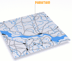 Places with similar names to Pabātair, Bangladesh ::
// Pobiedr (PL)
Disclaimer :: Information on this page comes without warranty of any kind |
||
|
Where is Pabātair? Elevation and coordinates ::
Latitude (lat): 24°50'0"N Longitude (lon): 88°44'0"E
Elevation (approx.): 23m (map arrows pan, magnifying glasses zoom) |
||
|
Visiting Pabātair? Hotel/Accommodation ::
Book a hotel in Pabātair Travel Guide ::
Buy a travel guide for Bangladesh rental cars ::
car rental offers GPS waypoint ::
download a GPX waypoint (PoI) of Pabātair for your GPS receiver
|
||