|
search place name
|
||
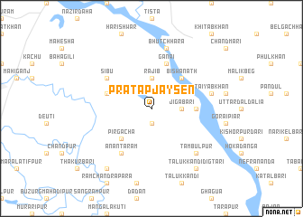
Pratāp Jaysen (Barisāl, Bangladesh)Pratāp Jaysen is a town in the Barisāl region of Bangladesh. An overview map of the region around Pratāp Jaysen is displayed below.
regional and 3d topo map of Pratāp Jaysen, Bangladesh ::
Pratāp Jaysen airports ::
The nearest airport is SPD - Saidpur, located 54.7 km west of Pratāp Jaysen.
Other airports nearby include COH - Cooch-behar Cooch Behar (69.9 km north), IXB - Baghdogra Bagdogra (156.1 km north west), RJH - Rajshahi Shah Mokhdum (163.2 km south west), IRD - Ishurdi (176.1 km south), Nearby towns ::
Kekoān Nabu (1.9km south) //
Jigābāri (3.3km east) //
Rājib (3.7km north) //
Bāje Mazkur (3.7km north) //
Biswānāth (5.0km north east) //
Pirgacha (5.0km south west) //
Gābura (5.0km east) //
Itākumāri (5.3km west) //
Ganāi (5.8km north) //
Jādu Laskar (6.2km north west) //
Sību (6.2km north west) //
Anantarām (6.5km south west) //
Bhutchhāra (7.6km north) //
Taiyab Khān (6.9km east) //
Tāmbulpur (7.5km south east) //
Tāluk Isād (8.9km south west) //
Tāluk Kāndi Digtāri (8.9km south east) //
[all distances 'as the bird flies' and approximate] 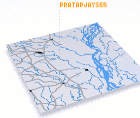 Places with similar names to Pratāp Jaysen, Bangladesh :: Disclaimer :: Information on this page comes without warranty of any kind |
||
|
Where is Pratāp Jaysen? Elevation and coordinates ::
Latitude (lat): 25°42'0"N Longitude (lon): 89°27'0"E
Elevation (approx.): 31m (map arrows pan, magnifying glasses zoom) |
||
|
Visiting Pratāp Jaysen? Hotel/Accommodation ::
Book a hotel in Pratāp Jaysen Travel Guide ::
Buy a travel guide for Bangladesh rental cars ::
car rental offers GPS waypoint ::
download a GPX waypoint (PoI) of Pratāp Jaysen for your GPS receiver
|
||