|
search place name
|
||
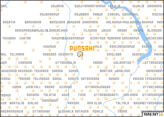
Punsāhi (Barisāl, Bangladesh)Punsāhi is a town in the Barisāl region of Bangladesh. An overview map of the region around Punsāhi is displayed below.
regional and 3d topo map of Punsāhi, Bangladesh ::
Punsāhi airports ::
The nearest airport is DAC - Dhaka Zia Intl, located 21.2 km south west of Punsāhi.
Other airports nearby include IXA - Agartala (74.7 km east), IRD - Ishurdi (150.2 km west), IXH - Kailashahar (155.3 km east), JSR - Jessore (165.3 km south west), Nearby towns ::
Chhātiāni (0.0km north) //
Lonāba (0.0km north) //
Bāsiārati (0.0km north) //
Bauna (0.0km north) //
Rayen (0.0km north) //
Narun (1.9km north) //
Bāriādi (1.9km north) //
Barāya (1.9km north) //
Marās (1.9km north) //
Kāulita (2.5km north east) //
Sarusuāchhla (2.5km north east) //
Goailbari (2.5km south east) //
Kulthun (2.5km north east) //
Musundi (2.5km north east) //
Kāmāria (2.5km south west) //
Deotala (3.7km north) //
Kesarita (3.4km west) //
Chamurkhi (4.1km north east) //
Sāldia (3.9km north east) //
Nāoān (3.9km south east) //
Kalun (3.9km south east) //
Brāhmangaon (3.9km south east) //
Atlāba (3.9km south east) //
Jāngālia (3.9km north east) //
Sekher Narun (4.1km north west) //
Kumun (4.1km south west) //
Bil Belāi (4.1km south west) //
Bāria (4.1km south west) //
Pākuria (3.9km south west) //
[all distances 'as the bird flies' and approximate] 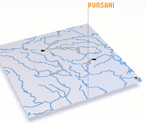 Places with similar names to Punsāhi, Bangladesh ::
Disclaimer :: Information on this page comes without warranty of any kind |
||
|
Where is Punsāhi? Elevation and coordinates ::
Latitude (lat): 24°0'0"N Longitude (lon): 90°31'0"E
Elevation (approx.): 9m (map arrows pan, magnifying glasses zoom) |
||
|
Visiting Punsāhi? Hotel/Accommodation ::
Book a hotel in Punsāhi Travel Guide ::
Buy a travel guide for Bangladesh rental cars ::
car rental offers GPS waypoint ::
download a GPX waypoint (PoI) of Punsāhi for your GPS receiver
|
||