|
search place name
|
||
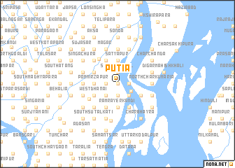
Putia (Barisāl, Bangladesh)Putia is a town in the Barisāl region of Bangladesh. An overview map of the region around Putia is displayed below.
regional and 3d topo map of Putia, Bangladesh ::
Putia airports ::
The nearest airport is DAC - Dhaka Zia Intl, located 73.3 km north of Putia.
Other airports nearby include IXA - Agartala (112.2 km north east), JSR - Jessore (132.0 km west), CGP - Chittagong Shah Amanat Intl (174.1 km south east), IRD - Ishurdi (178.7 km north west), Nearby towns ::
Singjāla (0.0km north) //
Ikarkāndi (0.0km north) //
Dhanai (1.9km south) //
Sidya (1.9km south) //
Gaidya (1.9km north) //
Surjyadighāl (1.9km north) //
Nārāyanpur (1.7km east) //
Chandālkāndi (1.7km west) //
Sājanpur (1.7km west) //
Putijuri (1.7km west) //
Kāichkuri (1.7km west) //
Thākurtakāndi (2.3km south east) //
West Nāndra (2.5km south east) //
Bāaikāndi (2.5km south east) //
Mānua (2.5km south west) //
Saiyadbasta (2.5km south west) //
Guākhola (2.5km south east) //
Bāsudebpur (2.5km south east) //
North Dāmadya (3.7km south) //
Goālkua (3.7km south) //
Rāmrāyerkāndi (3.7km south) //
Pom Mīrzāpur (3.4km west) //
Āijhāra (3.4km west) //
Bara Chhaygaon (3.4km west) //
Pom (3.4km west) //
Ārāzi Pom (3.4km west) //
Satyapur (3.7km north) //
Bhātita (3.7km north) //
Gāzipur (3.9km south east) //
[all distances 'as the bird flies' and approximate] 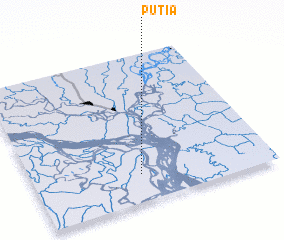 Places with similar names to Putia, Bangladesh ::
Disclaimer :: Information on this page comes without warranty of any kind |
||
|
Where is Putia? Elevation and coordinates ::
Latitude (lat): 23°11'0"N Longitude (lon): 90°27'0"E
Elevation (approx.): 6m (map arrows pan, magnifying glasses zoom) |
||
|
Visiting Putia? Hotel/Accommodation ::
Book a hotel in Putia Travel Guide ::
Buy a travel guide for Bangladesh rental cars ::
car rental offers GPS waypoint ::
download a GPX waypoint (PoI) of Putia for your GPS receiver
|
||