|
search place name
|
||
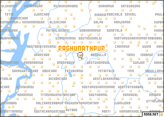
Raghunāthpur (Barisāl, Bangladesh)Raghunāthpur is a town in the Barisāl region of Bangladesh. An overview map of the region around Raghunāthpur is displayed below.
regional and 3d topo map of Raghunāthpur, Bangladesh ::
Raghunāthpur airports ::
The nearest airport is IXA - Agartala, located 45.2 km north east of Raghunāthpur.
Other airports nearby include DAC - Dhaka Zia Intl (51.6 km west), IXH - Kailashahar (136.1 km north east), ZYL - Sylhet Osmani Osmany Intl (175.9 km north east), JSR - Jessore (182.3 km west), Nearby towns ::
Chandi Char (0.0km north) //
Kāchhārikāndi (1.9km north) //
Kripārāmpur (1.9km north) //
North Chander Char (1.9km north) //
Nāgerkāndi (1.9km south) //
North Nāger Char (2.5km north east) //
Hārpākna (2.5km north east) //
Kālāgāchhia (2.5km north west) //
Chhota Ālir Char (2.5km south east) //
Sureswardi (2.5km south east) //
Bhāsānia (2.5km south west) //
West Kāshipur (2.5km south west) //
South Bāluākāndi (3.7km north) //
Matkir Char (3.4km east) //
Sonāulla (3.4km east) //
Ghārmora (3.4km west) //
Gāngātia (3.7km south) //
Bara Ālir Char (3.7km south) //
Chhota Kaijuri (4.1km north east) //
Kadamtali (4.1km north east) //
Mirzāpur (4.1km north east) //
South Dighaldi (4.1km north east) //
Tebhāgia (4.1km north west) //
West Ghorāsāl (3.9km south east) //
Dhanirāmpur (3.9km south east) //
Āsādpur (3.9km north west) //
Nārāyanpur (3.9km north west) //
Sātmora (4.1km south east) //
Chhabullākāndi (4.1km south east) //
[all distances 'as the bird flies' and approximate]  Places with similar names to Raghunāthpur, Bangladesh ::
// Raghunāthpur (BD)
// Raghunāthpur (BD)
// Raghunāthpur (BD)
// Raghunāthpur (BD)
// Raghunāthpur (BD)
// Raghunāthpur (BD)
// Raghunāthpur (BD)
// Raghunāthpur (BD)
// Raghunāthpur (BD)
// Raghunāthpur (BD)
Disclaimer :: Information on this page comes without warranty of any kind |
||
|
Where is Raghunāthpur? Elevation and coordinates ::
Latitude (lat): 23°40'0"N Longitude (lon): 90°52'0"E
Elevation (approx.): 11m (map arrows pan, magnifying glasses zoom) |
||
|
Visiting Raghunāthpur? Hotel/Accommodation ::
Book a hotel in Raghunāthpur Travel Guide ::
Buy a travel guide for Bangladesh rental cars ::
car rental offers GPS waypoint ::
download a GPX waypoint (PoI) of Raghunāthpur for your GPS receiver
|
||