|
search place name
|
||
Rāi Dakshin (Dhaka, Bangladesh)Rāi Dakshin is a town in the Dhaka region of Bangladesh. An overview map of the region around Rāi Dakshin is displayed below.
regional and 3d topo map of Rāi Dakshin, Bangladesh ::

Rāi Dakshin airports ::
The nearest airport is DAC - Dhaka Zia Intl, located 19.9 km east of Rāi Dakshin.
Other airports nearby include IXA - Agartala (105.5 km east), IRD - Ishurdi (124.5 km west), JSR - Jessore (126.8 km south west), RJH - Rajshahi Shah Mokhdum (176.8 km north west), Nearby towns ::
Gājinda (0.9km north east) //
Tepākhola (0.9km north east) //
Medulia (0.9km north east) //
Ātālia (0.9km north east) //
Bhākum (1.1km north west) //
Jaymandap (1.1km north west) //
Bhum Dakshin (1.1km north west) //
Swalpa Jāilla (1.6km south east) //
Hātni (1.6km south east) //
Khalāsur (1.6km south east) //
Ālokdia (1.6km south east) //
Pānisāil (1.6km south east) //
Chāprāil (1.7km south west) //
Ulāil (2.4km north) //
Pāna Noāripāra (2.4km north) //
Khāser Char Dwitiya Khanda (2.4km north) //
Kāmura (2.5km north west) //
Nānguli (2.5km north west) //
Khāser Char Pratham Khanda (2.5km north west) //
Sudkhira (2.5km east) //
Gāndhārdia (2.5km east) //
Purba Bāsta (2.5km east) //
Nāzirpur (2.7km west) //
Bāthi (2.7km west) //
Niltek (2.7km west) //
Deuli Lakshmidia (2.7km west) //
Kamālnagar (2.7km west) //
Dāutia (2.8km south east) //
Kālābaga (2.8km south east) //
[all distances 'as the bird flies' and approximate] 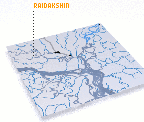 Places with similar names to Rāi Dakshin, Bangladesh ::
// Reduction (US)
Disclaimer :: Information on this page comes without warranty of any kind |
||
|
Where is Rāi Dakshin? Elevation and coordinates ::
Latitude (lat): 23°47'45"N Longitude (lon): 90°12'34"E
Elevation (approx.): 6m (map arrows pan, magnifying glasses zoom) |
||
|
Visiting Rāi Dakshin? Hotel/Accommodation ::
Book a hotel in Rāi Dakshin Travel Guide ::
Buy a travel guide for Bangladesh rental cars ::
car rental offers GPS waypoint ::
download a GPX waypoint (PoI) of Rāi Dakshin for your GPS receiver
|
||