|
search place name
|
||
Rākhāl Buruz (Barisāl, Bangladesh)Rākhāl Buruz is a town in the Barisāl region of Bangladesh. An overview map of the region around Rākhāl Buruz is displayed below.
regional and 3d topo map of Rākhāl Buruz, Bangladesh ::

Rākhāl Buruz airports ::
The nearest airport is SPD - Saidpur, located 87.8 km north west of Rākhāl Buruz.
Other airports nearby include RJH - Rajshahi Shah Mokhdum (116.7 km south west), IRD - Ishurdi (118.3 km south), COH - Cooch-behar Cooch Behar (130.8 km north), DAC - Dhaka Zia Intl (172.8 km south east), Nearby towns ::
Kājla (2.5km north west) //
Harīrāmpur (3.7km north) //
Lontala (3.4km west) //
Kachua (3.8km south east) //
Pantāi (4.1km south west) //
Bochādaha (5.0km south east) //
Srīpatīpur (5.8km south) //
Krorgāchha (5.8km north) //
Pogail (5.8km north) //
Ārāzi Sāhāpur (6.5km south west) //
Simultari (7.0km east) //
Bardhankuthi (7.0km west) //
Kunja Nākai (7.6km north) //
Bonārpāra (7.7km north east) //
Tāluk Kānupur (8.7km north west) //
Marādātia (9.0km north east) //
Jagannāthpur (10.0km south west) //
[all distances 'as the bird flies' and approximate] 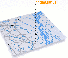 Places with similar names to Rākhāl Buruz, Bangladesh :: Disclaimer :: Information on this page comes without warranty of any kind |
||
|
Where is Rākhāl Buruz? Elevation and coordinates ::
Latitude (lat): 25°9'0"N Longitude (lon): 89°28'0"E
Elevation (approx.): 19m (map arrows pan, magnifying glasses zoom) |
||
|
Visiting Rākhāl Buruz? Hotel/Accommodation ::
Book a hotel in Rākhāl Buruz Travel Guide ::
Buy a travel guide for Bangladesh rental cars ::
car rental offers GPS waypoint ::
download a GPX waypoint (PoI) of Rākhāl Buruz for your GPS receiver
|
||