|
search place name
|
||
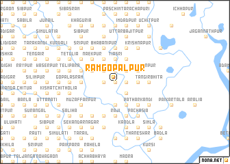
Rām Gopālpur (Barisāl, Bangladesh)Rām Gopālpur is a town in the Barisāl region of Bangladesh. An overview map of the region around Rām Gopālpur is displayed below.
regional and 3d topo map of Rām Gopālpur, Bangladesh ::
Rām Gopālpur airports ::
The nearest airport is IXA - Agartala, located 87.8 km south of Rām Gopālpur.
Other airports nearby include ZYL - Sylhet Osmani Osmany Intl (99.6 km east), DAC - Dhaka Zia Intl (103.9 km south west), IXH - Kailashahar (113.1 km east), IRD - Ishurdi (200.0 km west), Nearby towns ::
Chatrakona (0.0km north) //
Rudrasri (0.0km north) //
Fatepur (0.0km north) //
Kāwāli Binni (1.9km north) //
Daulatpur (1.9km north) //
Sibpāsa (1.9km north) //
Mātua (1.9km north) //
Ālamsri (1.7km west) //
Dewānpāra (1.7km west) //
Bāragharia (1.7km east) //
Dakshin Hāsanpur (2.5km south east) //
Karina (2.5km south east) //
Sāidpur (2.5km north east) //
Bālāli (2.5km north east) //
Mākhna (2.5km north west) //
Biāsi (3.4km east) //
Dhānkunia (3.7km south) //
Lāchhārkānda (3.7km south) //
Tiasri (3.7km north) //
Bāraiura (3.7km north) //
Uttar Hāsanpur (3.8km north east) //
Malliknagar (3.8km north east) //
Bāghmāra (3.8km north east) //
Galli (4.1km south east) //
Harīpur (4.1km south east) //
Rāj Deotala (3.8km north west) //
Gābar Deotala (3.8km north west) //
Sridharpur (4.1km north east) //
Bāsta (4.1km north west) //
[all distances 'as the bird flies' and approximate]  Places with similar names to Rām Gopālpur, Bangladesh ::
Disclaimer :: Information on this page comes without warranty of any kind |
||
|
Where is Rām Gopālpur? Elevation and coordinates ::
Latitude (lat): 24°38'0"N Longitude (lon): 90°57'0"E
Elevation (approx.): 14m (map arrows pan, magnifying glasses zoom) |
||
|
Visiting Rām Gopālpur? Hotel/Accommodation ::
Book a hotel in Rām Gopālpur Travel Guide ::
Buy a travel guide for Bangladesh rental cars ::
car rental offers GPS waypoint ::
download a GPX waypoint (PoI) of Rām Gopālpur for your GPS receiver
|
||