|
search place name
|
||
Rāripāra (Barisāl, Bangladesh)Rāripāra is a town in the Barisāl region of Bangladesh. An overview map of the region around Rāripāra is displayed below.
regional and 3d topo map of Rāripāra, Bangladesh ::

Rāripāra airports ::
The nearest airport is RJH - Rajshahi Shah Mokhdum, located 50.1 km south of Rāripāra.
Other airports nearby include IRD - Ishurdi (88.4 km south east), SPD - Saidpur (99.3 km north), COH - Cooch-behar Cooch Behar (177.9 km north east), JSR - Jessore (194.0 km south), Nearby towns ::
Chak Kandarpapur (0.0km north) //
Mādhabpāra (0.0km north) //
Kandarpapur (0.0km north) //
Chak Jāmdai (1.9km south) //
Chak Binod (1.9km south) //
Chak Sibrāmpur (1.9km south) //
Ichhāpur (1.9km north) //
Haripur (1.7km east) //
Tanka Sibpur (1.7km east) //
Rāmrāipur (1.7km east) //
Bāgdob (1.7km east) //
Chāndās (1.7km west) //
Dimjāon (1.7km east) //
Chak Bhālāin (2.5km south west) //
Bhālāin (2.5km south west) //
Anantapur (2.5km south east) //
Deuli (2.5km north west) //
Chākla (2.5km north east) //
Karnator (2.5km north east) //
Panditpur (2.5km north west) //
Lakshmīpur (2.5km north east) //
Rāmcharanpur (3.4km east) //
Gorara (3.7km south) //
Jāmdai (3.7km south) //
Ākhirāpāra (3.4km west) //
Kānchan (3.4km west) //
Hāzrāpukur (3.4km west) //
Jantail (3.4km west) //
Helencha (3.7km north) //
[all distances 'as the bird flies' and approximate] 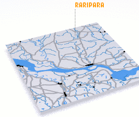 Places with similar names to Rāripāra, Bangladesh ::
Disclaimer :: Information on this page comes without warranty of any kind |
||
|
Where is Rāripāra? Elevation and coordinates ::
Latitude (lat): 24°53'0"N Longitude (lon): 88°42'0"E
Elevation (approx.): 20m (map arrows pan, magnifying glasses zoom) |
||
|
Visiting Rāripāra? Hotel/Accommodation ::
Book a hotel in Rāripāra Travel Guide ::
Buy a travel guide for Bangladesh rental cars ::
car rental offers GPS waypoint ::
download a GPX waypoint (PoI) of Rāripāra for your GPS receiver
|
||