|
search place name
|
||
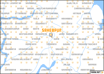
Sāhebpur (Barisāl, Bangladesh)Sāhebpur is a town in the Barisāl region of Bangladesh. An overview map of the region around Sāhebpur is displayed below.
regional and 3d topo map of Sāhebpur, Bangladesh ::
Sāhebpur airports ::
The nearest airport is JSR - Jessore, located 139.9 km north west of Sāhebpur.
Other airports nearby include DAC - Dhaka Zia Intl (141.5 km north), CGP - Chittagong Shah Amanat Intl (154.7 km east), IXA - Agartala (172.3 km north east), CCU - Calcutta Netaji Subhash Chandra Bose Intl (195.9 km west), Nearby towns ::
Bahadurpur (0.0km north) //
Char Sāhebpur (0.0km north) //
Tabirkāti (1.9km north) //
Boālia (1.9km north) //
Sobhākāti (1.7km west) //
Char Rāngasri (1.9km south) //
Bākarganj (1.9km south) //
Helencha (1.9km south) //
Runsi Pasuri (1.7km east) //
Khairābād (1.7km east) //
Deuli (1.7km east) //
Kāthgarpālwāntola (2.5km north west) //
Pitambarganj (2.5km north west) //
Bātājor (2.5km north west) //
Bāligrām (2.5km north east) //
Nurpur (2.5km north east) //
Rāngasri (2.5km south west) //
Hirādhar (2.5km south east) //
Dingār Hāt (2.5km south east) //
Guria (2.5km south east) //
Dāokāti (3.4km west) //
Nandapāra (3.4km west) //
Baria (3.4km west) //
Char Samasdi Bāligrām (3.7km north) //
Imāmkāti (3.7km north) //
Nāgerkati (3.7km north) //
Nilganj (3.4km east) //
Junia (3.4km east) //
Gābhikhola (3.4km east) //
[all distances 'as the bird flies' and approximate]  Places with similar names to Sāhebpur, Bangladesh ::
// Sāhibpur (BD)
Disclaimer :: Information on this page comes without warranty of any kind |
||
|
Where is Sāhebpur? Elevation and coordinates ::
Latitude (lat): 22°34'0"N Longitude (lon): 90°21'0"E
Elevation (approx.): -32768m (map arrows pan, magnifying glasses zoom) |
||
|
Visiting Sāhebpur? Hotel/Accommodation ::
Book a hotel in Sāhebpur Travel Guide ::
Buy a travel guide for Bangladesh rental cars ::
car rental offers GPS waypoint ::
download a GPX waypoint (PoI) of Sāhebpur for your GPS receiver
|
||