|
search place name
|
||
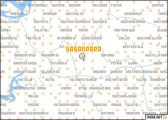
Sāsanpāra (Barisāl, Bangladesh)Sāsanpāra is a town in the Barisāl region of Bangladesh. An overview map of the region around Sāsanpāra is displayed below.
regional and 3d topo map of Sāsanpāra, Bangladesh ::
Sāsanpāra airports ::
The nearest airport is DAC - Dhaka Zia Intl, located 65.1 km north west of Sāsanpāra.
Other airports nearby include IXA - Agartala (69.1 km north east), IXH - Kailashahar (157.6 km north east), CGP - Chittagong Shah Amanat Intl (163.4 km south east), JSR - Jessore (171.1 km west), Nearby towns ::
North Shibpur (0.0km north) //
Āshārkota (1.7km east) //
Āliāra (1.9km south) //
Nandanpur (1.9km south) //
North Padua (1.9km north) //
Silāstambha (1.9km north) //
Shibpur (1.7km west) //
Kundapur (1.7km west) //
Temai (1.7km west) //
Singua (2.5km south east) //
Khilmeher (2.5km south east) //
Budhanda (2.5km north east) //
Chāratbhānga (2.5km south west) //
Kāndirāypur (2.5km south west) //
Ghona (2.5km north west) //
Godpur (2.5km north west) //
Baradail (2.5km north west) //
Nindapur (2.5km north west) //
Kāziāra (2.8km south) //
Pāthair (3.5km north) //
Bhāti Chināia (3.7km north) //
Adoār (3.7km north) //
Atiswar (3.7km north) //
Ghorādhāri (3.4km west) //
Prasannakāp (4.1km south east) //
Ujān Chināia (4.1km north east) //
Sāchār (4.1km north east) //
North Gobindapur (4.1km south west) //
Kālikāpur (4.1km south west) //
[all distances 'as the bird flies' and approximate]  Places with similar names to Sāsanpāra, Bangladesh ::
// Sāsanpur (BD)
Disclaimer :: Information on this page comes without warranty of any kind |
||
|
Where is Sāsanpāra? Elevation and coordinates ::
Latitude (lat): 23°24'0"N Longitude (lon): 90°49'0"E
Elevation (approx.): 6m (map arrows pan, magnifying glasses zoom) |
||
|
Visiting Sāsanpāra? Hotel/Accommodation ::
Book a hotel in Sāsanpāra Travel Guide ::
Buy a travel guide for Bangladesh rental cars ::
car rental offers GPS waypoint ::
download a GPX waypoint (PoI) of Sāsanpāra for your GPS receiver
|
||