|
search place name
|
||
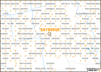
Shyāmpur (Barisāl, Bangladesh)Shyāmpur is a town in the Barisāl region of Bangladesh. An overview map of the region around Shyāmpur is displayed below.
regional and 3d topo map of Shyāmpur, Bangladesh ::
Shyāmpur airports ::
The nearest airport is IXA - Agartala, located 65.6 km north of Shyāmpur.
Other airports nearby include DAC - Dhaka Zia Intl (89.8 km north west), CGP - Chittagong Shah Amanat Intl (140.9 km south east), IXH - Kailashahar (145.8 km north east), AJL - Aizwal Aizawl (183.6 km east), Nearby towns ::
Ranāitali (0.0km north) //
Betua (0.0km north) //
Adra (1.6km west) //
Tārābāria (1.9km north) //
Daniswar (1.9km north) //
Bhaiskhola (1.9km north) //
Jorpukuria (1.9km north) //
Sialora (1.9km north) //
Bankara (1.7km east) //
Srīpur (1.9km south) //
Gazāria (1.9km south) //
Samaspur (1.9km south) //
Solāpukuria (1.7km west) //
Jhāpua (1.7km west) //
Ghoshaya (2.5km north east) //
Tārāpukuria (2.5km north west) //
Beki (2.5km north west) //
Kaiyāni (2.5km north west) //
Gāzipur (2.5km south east) //
Gālimpur (2.5km south east) //
Tārāpur (2.5km south east) //
Tulāgaon (2.5km south west) //
Dalua (2.5km south west) //
Rārhi (2.5km south west) //
Dakshin Payālgāchha (3.4km south west) //
Kapāstali (3.4km east) //
East Gobindāpur (3.7km north) //
Kamedda (3.7km north) //
Fenua (3.7km north) //
[all distances 'as the bird flies' and approximate] 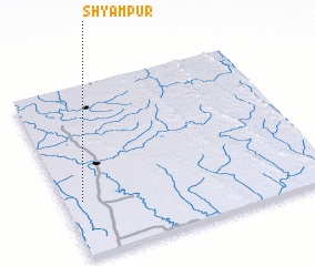 Places with similar names to Shyāmpur, Bangladesh ::
Disclaimer :: Information on this page comes without warranty of any kind |
||
|
Where is Shyāmpur? Elevation and coordinates ::
Latitude (lat): 23°19'0"N Longitude (lon): 91°4'0"E
Elevation (approx.): 10m (map arrows pan, magnifying glasses zoom) |
||
|
Visiting Shyāmpur? Hotel/Accommodation ::
Book a hotel in Shyāmpur Travel Guide ::
Buy a travel guide for Bangladesh rental cars ::
car rental offers GPS waypoint ::
download a GPX waypoint (PoI) of Shyāmpur for your GPS receiver
|
||