|
search place name
|
||
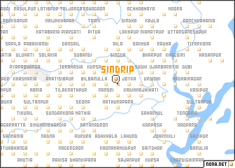
Sindrip (Barisāl, Bangladesh)Sindrip is a town in the Barisāl region of Bangladesh. An overview map of the region around Sindrip is displayed below.
regional and 3d topo map of Sindrip, Bangladesh ::
Sindrip airports ::
The nearest airport is IXA - Agartala, located 69.0 km south east of Sindrip.
Other airports nearby include DAC - Dhaka Zia Intl (80.4 km south west), IXH - Kailashahar (114.7 km east), ZYL - Sylhet Osmani Osmany Intl (116.5 km north east), IRD - Ishurdi (188.5 km west), Nearby towns ::
Hālgara (0.0km north) //
Noābād (1.9km north) //
Āndhār Mānik (1.9km north) //
Pārābālia (1.9km north) //
Kāndāil (1.7km west) //
Ulukhala (1.7km west) //
Pātāljān (1.7km west) //
Joyka (1.7km east) //
Ratanpur (1.7km east) //
Pānāhār (1.7km east) //
Kāmār Ātia (1.9km south) //
Bāje Pātdha (2.5km north west) //
Mātikāta (2.5km north west) //
Mulāmkhār Char (2.5km north east) //
Jhāutala (2.5km north east) //
Nānsri (2.5km south west) //
Pārākul (2.5km south east) //
Khojārgaon (2.5km south east) //
Singua (3.7km north) //
Kumuria (3.7km north) //
Bhāngakhāli (3.7km north) //
Bil Barulla (3.4km west) //
Sultānnagar (3.4km east) //
Gundhar (3.4km east) //
Madan (3.4km east) //
Mathurāpāra (3.7km south) //
Jāfrābād (4.1km north west) //
Noākāndi (4.1km north west) //
Sādher Jangal (3.9km north west) //
[all distances 'as the bird flies' and approximate] 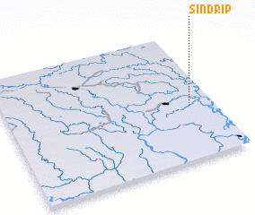 Places with similar names to Sindrip, Bangladesh ::
Disclaimer :: Information on this page comes without warranty of any kind |
||
|
Where is Sindrip? Elevation and coordinates ::
Latitude (lat): 24°25'0"N Longitude (lon): 90°53'0"E
Elevation (approx.): 8m (map arrows pan, magnifying glasses zoom) |
||
|
Visiting Sindrip? Hotel/Accommodation ::
Book a hotel in Sindrip Travel Guide ::
Buy a travel guide for Bangladesh rental cars ::
car rental offers GPS waypoint ::
download a GPX waypoint (PoI) of Sindrip for your GPS receiver
|
||