|
search place name
|
||
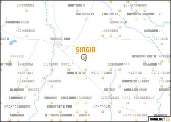
Singia (Barisāl, Bangladesh)Singia is a town in the Barisāl region of Bangladesh. An overview map of the region around Singia is displayed below.
regional and 3d topo map of Singia, Bangladesh ::
Singia airports ::
The nearest airport is SPD - Saidpur, located 47.5 km south east of Singia.
Other airports nearby include IXB - Baghdogra Bagdogra (77.8 km north), COH - Cooch-behar Cooch Behar (101.8 km east), BIR - Biratnagar (136.0 km north west), RJH - Rajshahi Shah Mokhdum (173.4 km south), Nearby towns ::
Gauripur (1.9km south) //
Jagannāthpur (2.5km north west) //
Bhopla (3.7km south) //
Daulatpur (4.1km south west) //
Nārgun (3.8km south west) //
Madansānko (5.0km south east) //
Dhangaon (5.3km east) //
Thākurgaon (6.2km north west) //
Kiārīgaon (6.5km north east) //
Gobindapāra (6.9km east) //
Gilābāri (6.9km west) //
Lashkara (7.5km north east) //
Gareya (8.7km north east) //
Dagrai Khātiādighi (8.7km south east) //
Sātair (8.9km south east) //
Bochāpukur (8.7km south west) //
Gopālpur (10.0km north east) //
[all distances 'as the bird flies' and approximate] 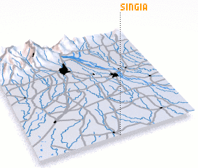 Places with similar names to Singia, Bangladesh ::
Disclaimer :: Information on this page comes without warranty of any kind |
||
|
Where is Singia? Elevation and coordinates ::
Latitude (lat): 26°0'0"N Longitude (lon): 88°31'0"E
Elevation (approx.): 56m (map arrows pan, magnifying glasses zoom) |
||
|
Visiting Singia? Hotel/Accommodation ::
Book a hotel in Singia Travel Guide ::
Buy a travel guide for Bangladesh rental cars ::
car rental offers GPS waypoint ::
download a GPX waypoint (PoI) of Singia for your GPS receiver
|
||