|
search place name
|
||
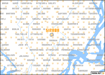
Sirāba (Barisāl, Bangladesh)Sirāba is a town in the Barisāl region of Bangladesh. An overview map of the region around Sirāba is displayed below.
regional and 3d topo map of Sirāba, Bangladesh ::
Sirāba airports ::
The nearest airport is DAC - Dhaka Zia Intl, located 22.5 km north west of Sirāba.
Other airports nearby include IXA - Agartala (69.1 km east), JSR - Jessore (157.6 km south west), IXH - Kailashahar (158.2 km north east), IRD - Ishurdi (162.9 km west), Nearby towns ::
Utma (0.0km north) //
Kobāga (0.0km north) //
Hāturāpāra (1.9km south) //
Maishtek (1.9km south) //
Ālampur (1.9km south) //
Kaltāpāra (1.9km south) //
Bharat (1.7km west) //
Sādipur (1.7km west) //
Dāsnaogaon (1.7km west) //
Baragaon (1.7km west) //
Bastal (1.7km east) //
Brāhmanbāga (1.7km east) //
Kāzipāra (1.7km east) //
Sekherhāt (1.7km east) //
Sinlāba (1.9km north) //
Pākunda (1.9km north) //
Pechānga (1.9km north) //
Nānākhi (2.2km south) //
Baraibāri (2.5km south west) //
Nayāpur (2.5km south west) //
Barāba (2.5km south west) //
Purba Darikāndi (2.5km south east) //
Tilāba (2.5km south east) //
Muchhār Char (2.5km south east) //
Daulardi (2.5km south east) //
Airāba (2.5km north west) //
Perāba (2.5km north west) //
Rāutgaon (2.5km north east) //
Bara Mājher Char (2.5km north east) //
[all distances 'as the bird flies' and approximate] 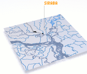 Places with similar names to Sirāba, Bangladesh ::
Disclaimer :: Information on this page comes without warranty of any kind |
||
|
Where is Sirāba? Elevation and coordinates ::
Latitude (lat): 23°44'0"N Longitude (lon): 90°35'0"E
Elevation (approx.): 7m (map arrows pan, magnifying glasses zoom) |
||
|
Visiting Sirāba? Hotel/Accommodation ::
Book a hotel in Sirāba Travel Guide ::
Buy a travel guide for Bangladesh rental cars ::
car rental offers GPS waypoint ::
download a GPX waypoint (PoI) of Sirāba for your GPS receiver
|
||