|
search place name
|
||
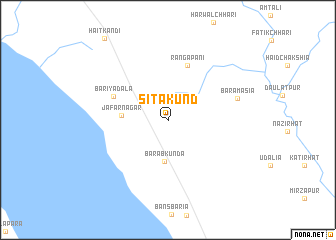
Sītākund (Chittagong, Bangladesh)Sītākund is a town in the Chittagong region of Bangladesh. An overview map of the region around Sītākund is displayed below.
regional and 3d topo map of Sītākund, Bangladesh ::
Sītākund airports ::
The nearest airport is CGP - Chittagong Shah Amanat Intl, located 46.5 km south of Sītākund.
Other airports nearby include CXB - Cox's Bazar Coxs Bazar (135.7 km south), IXA - Agartala (144.2 km north), AJL - Aizwal Aizawl (168.8 km north east), DAC - Dhaka Zia Intl (185.4 km north west), Nearby towns ::
Barabkunda (4.7km south) //
Jāfarnagar (4.8km west) //
Rāngāpāni (6.4km north) //
Bariyadala (6.2km north west) //
Bāramāsia (7.6km east) //
[all distances 'as the bird flies' and approximate] 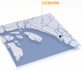 Places with similar names to Sītākund, Bangladesh ::
// Setegantí (PA)
// Stagnity (PL)
// Sidgunda (LV)
// Stigniţa (RO)
// Saidgānti (BD)
// Sāutikānda (BD)
// Sitāikunda (BD)
// Settigunta (IN)
// Saūdakent (KZ)
// Sütkent (KZ)
Disclaimer :: Information on this page comes without warranty of any kind |
||
|
Where is Sītākund? Elevation and coordinates ::
Latitude (lat): 22°38'43"N Longitude (lon): 91°39'48"E
Elevation (approx.): 67m (map arrows pan, magnifying glasses zoom) |
||
|
Visiting Sītākund? Hotel/Accommodation ::
Book a hotel in Sītākund Travel Guide ::
Buy a travel guide for Bangladesh rental cars ::
car rental offers GPS waypoint ::
download a GPX waypoint (PoI) of Sītākund for your GPS receiver
|
||