|
search place name
|
||
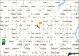
Som (Barisāl, Bangladesh)Som is a town in the Barisāl region of Bangladesh. An overview map of the region around Som is displayed below.
regional and 3d topo map of Som, Bangladesh ::
Som airports ::
The nearest airport is DAC - Dhaka Zia Intl, located 16.7 km west of Som.
Other airports nearby include IXA - Agartala (70.3 km east), IXH - Kailashahar (154.9 km east), IRD - Ishurdi (155.2 km west), JSR - Jessore (162.5 km south west), Nearby towns ::
Charerkhola (0.0km north) //
Bhadratola (0.0km north) //
Firinda (0.0km north) //
Ulua (0.0km north) //
Tiori (0.0km north) //
Malibanda (1.9km south) //
Bāghpāra (1.9km south) //
Rohila (1.9km south) //
Hankur (1.9km south) //
Pākuria (1.7km west) //
Dakshin Bhādārti (1.9km north) //
Tumlia Chak (1.9km north) //
Barihāti (1.7km east) //
Tumlia (1.9km north) //
Kalinga (1.7km east) //
Bhetair (1.9km north) //
Tek Mānikpur (1.7km west) //
Boāli (1.9km north) //
Piprāsāir (1.9km north) //
Ara (1.7km west) //
Bāgherdia (1.7km west) //
Ichhāpur (1.7km east) //
Bartul (1.7km east) //
Chāndkhola (1.7km west) //
Kāliganj (2.5km north east) //
Pārātek (2.5km south west) //
Dāudpur (2.5km south west) //
Khaisār (2.5km south east) //
Chāirpāra (2.5km south east) //
[all distances 'as the bird flies' and approximate] 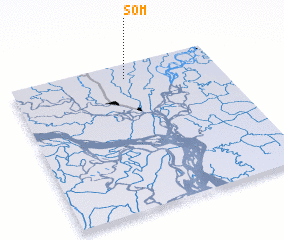 Places with similar names to Som, Bangladesh ::
Disclaimer :: Information on this page comes without warranty of any kind |
||
|
Where is Som? Elevation and coordinates ::
Latitude (lat): 23°54'0"N Longitude (lon): 90°33'0"E
Elevation (approx.): 9m (map arrows pan, magnifying glasses zoom) |
||
|
Visiting Som? Hotel/Accommodation ::
Book a hotel in Som Travel Guide ::
Buy a travel guide for Bangladesh rental cars ::
car rental offers GPS waypoint ::
download a GPX waypoint (PoI) of Som for your GPS receiver
|
||