|
search place name
|
||
Sondhārdia (Barisāl, Bangladesh)Sondhārdia is a town in the Barisāl region of Bangladesh. An overview map of the region around Sondhārdia is displayed below.
regional and 3d topo map of Sondhārdia, Bangladesh ::

Sondhārdia airports ::
The nearest airport is DAC - Dhaka Zia Intl, located 34.7 km north of Sondhārdia.
Other airports nearby include IXA - Agartala (98.9 km north east), JSR - Jessore (127.6 km west), IRD - Ishurdi (149.2 km north west), IXH - Kailashahar (189.3 km north east), Nearby towns ::
Kānanisār (0.0km north) //
Dakshin Chārigaon (1.9km south) //
Pāchaldia (1.9km south) //
Pārāgaon (1.7km west) //
Tantar (1.7km west) //
Rujdi (1.7km west) //
Purba Naopāra (1.7km east) //
Chāmārdi (1.7km east) //
Khilgaon (1.7km east) //
Pānia (1.7km east) //
Sinpāra (1.9km north) //
Uttargaon (1.7km east) //
Kusumpur (2.0km north east) //
Kalligaon (2.3km north west) //
Paschim Naopāra (2.5km south west) //
Bibandi (2.5km south west) //
Jainsār (2.5km south east) //
Tingaon (2.5km north west) //
Beltali (2.5km north west) //
Brāhmankhola (2.5km north east) //
Chhātiāntali (2.5km north east) //
Nandipāra (3.4km west) //
Hāsārgaon (3.4km west) //
Ātpāra (3.4km west) //
Bara Bāraigaon (3.4km west) //
Tārātia Chhota (3.4km west) //
Sindurdi (3.7km south) //
Surpāra (3.7km south) //
Baultali (3.7km south) //
[all distances 'as the bird flies' and approximate] 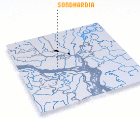 Places with similar names to Sondhārdia, Bangladesh :: Disclaimer :: Information on this page comes without warranty of any kind |
||
|
Where is Sondhārdia? Elevation and coordinates ::
Latitude (lat): 23°32'0"N Longitude (lon): 90°21'0"E
Elevation (approx.): 6m (map arrows pan, magnifying glasses zoom) |
||
|
Visiting Sondhārdia? Hotel/Accommodation ::
Book a hotel in Sondhārdia Travel Guide ::
Buy a travel guide for Bangladesh rental cars ::
car rental offers GPS waypoint ::
download a GPX waypoint (PoI) of Sondhārdia for your GPS receiver
|
||