|
search place name
|
||
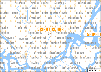
Srīpatir Char (Barisāl, Bangladesh)Srīpatir Char is a town in the Barisāl region of Bangladesh. An overview map of the region around Srīpatir Char is displayed below.
regional and 3d topo map of Srīpatir Char, Bangladesh ::
Srīpatir Char airports ::
The nearest airport is DAC - Dhaka Zia Intl, located 25.9 km north west of Srīpatir Char.
Other airports nearby include IXA - Agartala (70.7 km east), JSR - Jessore (155.5 km west), IXH - Kailashahar (160.6 km north east), IRD - Ishurdi (164.6 km west), Nearby towns ::
Pāika Sadardi (0.0km north) //
Kāndāpāra (0.0km north) //
Lāl Char (0.0km north) //
Panchami Ghāt (0.0km north) //
Uttar Dhura (0.0km north) //
Mīrer Char (1.9km south) //
Madhya Majher Char (1.9km south) //
Dakshin Char (1.9km south) //
Garibardi (1.9km south) //
Nitardi (1.9km south) //
Bhabānipur (1.9km south) //
Keodhāla (1.7km west) //
Kuchiāmora (1.7km west) //
Sanmāndi (1.7km east) //
Baidyer Kāndi (1.7km east) //
Mārabdi (1.7km east) //
Jātrābāri (1.7km east) //
Kumār Char (1.9km north) //
Joārdi (1.9km north) //
Bāghuri (1.9km north) //
Jāngāl (2.5km south west) //
Nāgalbanda (2.5km south west) //
Pāika (2.5km south east) //
Hāmchhādi (2.5km south east) //
Darpat Thotālia (2.5km south east) //
Daulatpur Thotālia (2.5km south east) //
Hazratpur (2.5km south east) //
Char Bāneswardi (2.5km south east) //
Āmdi (2.5km south east) //
[all distances 'as the bird flies' and approximate] 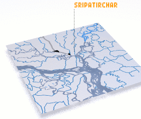 Places with similar names to Srīpatir Char, Bangladesh ::
// Srīpatir Char (BD)
Disclaimer :: Information on this page comes without warranty of any kind |
||
|
Where is Srīpatir Char? Elevation and coordinates ::
Latitude (lat): 23°41'0"N Longitude (lon): 90°35'0"E
Elevation (approx.): 5m (map arrows pan, magnifying glasses zoom) |
||
|
Visiting Srīpatir Char? Hotel/Accommodation ::
Book a hotel in Srīpatir Char Travel Guide ::
Buy a travel guide for Bangladesh rental cars ::
car rental offers GPS waypoint ::
download a GPX waypoint (PoI) of Srīpatir Char for your GPS receiver
|
||