|
search place name
|
||
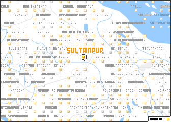
Sultānpur (Barisāl, Bangladesh)Sultānpur is a town in the Barisāl region of Bangladesh. An overview map of the region around Sultānpur is displayed below.
regional and 3d topo map of Sultānpur, Bangladesh ::
Sultānpur airports ::
The nearest airport is DAC - Dhaka Zia Intl, located 72.3 km east of Sultānpur.
Other airports nearby include JSR - Jessore (75.6 km south west), IRD - Ishurdi (91.5 km north west), RJH - Rajshahi Shah Mokhdum (145.5 km north west), IXA - Agartala (156.5 km east), Nearby towns ::
Char Syāmnagar (1.9km south) //
Khalilpur (1.7km east) //
Bāgchar (1.7km east) //
Dhuldi Lakshmipur (2.5km north west) //
Bara Raghunāthpur (2.5km north west) //
Sāilkāti (2.5km south west) //
Lakshmandia (2.5km south west) //
Sibrāmpur (2.5km north east) //
Ghanasyampur (2.5km north east) //
Chak Fatepur (2.5km north east) //
Khālisa Sonāpur (3.4km west) //
Rājāpur (3.4km west) //
Majlispur (3.7km north) //
Krishnanagar (3.7km south) //
Khālisa Rāmkāntapur (3.7km south) //
Rāmnagar (3.7km south) //
Rājāpur (3.4km east) //
Bara Bhabānipur (4.1km north west) //
Bājitpur (3.9km north west) //
Chāndpur (4.1km north east) //
Chak Bhabānipur (4.1km north east) //
Sadardi (4.1km south west) //
Chandipur (3.9km north east) //
Bishnupur (3.9km north east) //
Jaydebpur (3.9km north east) //
Char Krishnanagar (4.1km south east) //
Jāldia (5.0km south west) //
Madandia (5.0km north east) //
Sāstāpur (5.1km west) //
[all distances 'as the bird flies' and approximate] 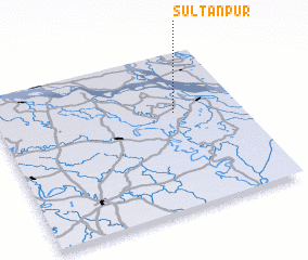 Places with similar names to Sultānpur, Bangladesh ::
Disclaimer :: Information on this page comes without warranty of any kind |
||
|
Where is Sultānpur? Elevation and coordinates ::
Latitude (lat): 23°37'0"N Longitude (lon): 89°44'0"E
Elevation (approx.): 12m (map arrows pan, magnifying glasses zoom) |
||
|
Visiting Sultānpur? Hotel/Accommodation ::
Book a hotel in Sultānpur Travel Guide ::
Buy a travel guide for Bangladesh rental cars ::
car rental offers GPS waypoint ::
download a GPX waypoint (PoI) of Sultānpur for your GPS receiver
|
||