|
search place name
|
||
Surjyanārāyanpur (Barisāl, Bangladesh)Surjyanārāyanpur is a town in the Barisāl region of Bangladesh. An overview map of the region around Surjyanārāyanpur is displayed below.
regional and 3d topo map of Surjyanārāyanpur, Bangladesh ::

Surjyanārāyanpur airports ::
The nearest airport is DAC - Dhaka Zia Intl, located 31.6 km south west of Surjyanārāyanpur.
Other airports nearby include IXA - Agartala (75.7 km east), IRD - Ishurdi (151.0 km west), IXH - Kailashahar (151.5 km east), ZYL - Sylhet Osmani Osmany Intl (165.5 km north east), Nearby towns ::
Nalgaon (1.9km south) //
Bāmangaon (2.5km north west) //
Rājābāri (2.5km south west) //
Jāmirār Char (2.5km north east) //
Bārun (2.5km south east) //
Pābur (2.5km south east) //
Dharpāra (3.7km south) //
Bāsudebpur (3.7km south) //
Bānār Hāola (3.4km east) //
Rāutkona (3.4km east) //
Khodādia (3.4km east) //
Berābāri (4.1km north west) //
Nārāyanpur (4.1km north west) //
Dushya Nārāyanpur (4.1km north east) //
Dalisota (4.1km south east) //
Chāndul (4.1km south east) //
Bhākoādi (4.1km south east) //
Kāndania (3.9km south east) //
Kotbājālia (3.9km south east) //
Mitālu (5.0km north west) //
Damdama (5.0km south west) //
Chināduli (5.0km north east) //
Papla (5.6km south) //
Tilsunia (5.6km south) //
Gobindapur (5.6km south) //
Boāli (5.6km south) //
Rāynanda (5.1km east) //
Dari Merun (5.1km east) //
Chārbaria (5.1km east) //
[all distances 'as the bird flies' and approximate] 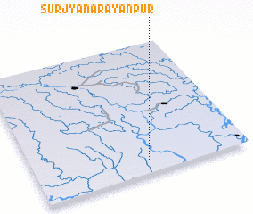 Places with similar names to Surjyanārāyanpur, Bangladesh ::
// Surjyanārāyanpur (BD)
Disclaimer :: Information on this page comes without warranty of any kind |
||
|
Where is Surjyanārāyanpur? Elevation and coordinates ::
Latitude (lat): 24°6'0"N Longitude (lon): 90°32'0"E
Elevation (approx.): 14m (map arrows pan, magnifying glasses zoom) |
||
|
Visiting Surjyanārāyanpur? Hotel/Accommodation ::
Book a hotel in Surjyanārāyanpur Travel Guide ::
Buy a travel guide for Bangladesh rental cars ::
car rental offers GPS waypoint ::
download a GPX waypoint (PoI) of Surjyanārāyanpur for your GPS receiver
|
||