|
search place name
|
||
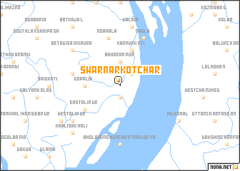
Swarnārkot Char (Barisāl, Bangladesh)Swarnārkot Char is a town in the Barisāl region of Bangladesh. An overview map of the region around Swarnārkot Char is displayed below.
regional and 3d topo map of Swarnārkot Char, Bangladesh ::
Swarnārkot Char airports ::
The nearest airport is CGP - Chittagong Shah Amanat Intl, located 126.9 km east of Swarnārkot Char.
Other airports nearby include CXB - Cox's Bazar Coxs Bazar (170.8 km south east), DAC - Dhaka Zia Intl (172.0 km north), JSR - Jessore (175.9 km north west), IXA - Agartala (188.2 km north), Nearby towns ::
Dasmina (1.9km south) //
Bānsbāria (2.5km north east) //
Baharampur (3.7km north) //
Gopāldi (5.1km west) //
Karpurkāti (5.8km north) //
East Ālipur (6.3km south west) //
Marddana (7.1km west) //
Noāmāla (7.6km north) //
Saula (8.2km north east) //
Betāgi Sānkipura (8.8km north west) //
West Ālipur (8.8km south west) //
Khalisākhāli (10.1km south west) //
[all distances 'as the bird flies' and approximate] 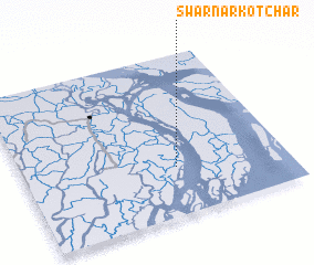 Places with similar names to Swarnārkot Char, Bangladesh :: Disclaimer :: Information on this page comes without warranty of any kind |
||
|
Where is Swarnārkot Char? Elevation and coordinates ::
Latitude (lat): 22°18'0"N Longitude (lon): 90°35'0"E
Elevation (approx.): 6m (map arrows pan, magnifying glasses zoom) |
||
|
Visiting Swarnārkot Char? Hotel/Accommodation ::
Book a hotel in Swarnārkot Char Travel Guide ::
Buy a travel guide for Bangladesh rental cars ::
car rental offers GPS waypoint ::
download a GPX waypoint (PoI) of Swarnārkot Char for your GPS receiver
|
||