|
search place name
|
||
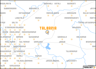
Tālbāria (Barisāl, Bangladesh)Tālbāria is a town in the Barisāl region of Bangladesh. An overview map of the region around Tālbāria is displayed below.
regional and 3d topo map of Tālbāria, Bangladesh ::
Tālbāria airports ::
The nearest airport is JSR - Jessore, located 18.0 km west of Tālbāria.
Other airports nearby include IRD - Ishurdi (107.6 km north), CCU - Calcutta Netaji Subhash Chandra Bose Intl (110.2 km south west), DAC - Dhaka Zia Intl (129.0 km north east), RJH - Rajshahi Shah Mokhdum (153.6 km north west), Nearby towns ::
Bāgherpāra (2.5km north east) //
Darājhāt (5.0km south west) //
Dohākula (5.4km east) //
Sukdebpur (5.4km west) //
Rāipur (6.5km north west) //
Jāmdia (6.3km south east) //
Khānpur (7.4km north) //
Rāmkrishnapur (6.8km west) //
Nārikelbāria (7.6km north) //
Rāmnagar (10.1km south west) //
[all distances 'as the bird flies' and approximate]  Places with similar names to Tālbāria, Bangladesh ::
// Dalebru (NO)
// Dilberi (BA)
// Tal-Liebru (MT)
// Dealu Bîrei (RO)
// Tulburea (RO)
// Tulburea (RO)
// Tulburea (RO)
// Tallobre (ES)
// Delbar (IR)
// Delbar (IR)
Disclaimer :: Information on this page comes without warranty of any kind |
||
|
Where is Tālbāria? Elevation and coordinates ::
Latitude (lat): 23°13'0"N Longitude (lon): 89°20'0"E
Elevation (approx.): 7m (map arrows pan, magnifying glasses zoom) |
||
|
Visiting Tālbāria? Hotel/Accommodation ::
Book a hotel in Tālbāria Travel Guide ::
Buy a travel guide for Bangladesh rental cars ::
car rental offers GPS waypoint ::
download a GPX waypoint (PoI) of Tālbāria for your GPS receiver
|
||