|
search place name
|
||
Uthali (Barisāl, Bangladesh)Uthali is a town in the Barisāl region of Bangladesh. An overview map of the region around Uthali is displayed below.
regional and 3d topo map of Uthali, Bangladesh ::

Uthali airports ::
The nearest airport is JSR - Jessore, located 50.7 km north of Uthali.
Other airports nearby include CCU - Calcutta Netaji Subhash Chandra Bose Intl (83.0 km west), IRD - Ishurdi (158.5 km north), DAC - Dhaka Zia Intl (170.0 km north east), RJH - Rajshahi Shah Mokhdum (199.5 km north), Nearby towns ::
Bāruipāra (0.0km north) //
Dhulanda (1.9km south) //
Chārikhāda (1.9km south) //
Chargrām (1.9km north) //
Mājhiāra (1.9km north) //
Nehālpur (1.7km east) //
Nāngla (1.7km west) //
Chāndapur (1.7km west) //
Uttar Deāra (2.5km south east) //
Māgura (2.5km south west) //
Ghona (2.5km north west) //
Nūrullāpur (2.5km north east) //
Gopālpur (2.5km north west) //
Mabārakpur (2.5km north east) //
Rahimābād (2.5km north east) //
Bāruihāti (2.5km north east) //
Sujansāha (2.5km north west) //
Gonāli (3.4km east) //
Nalta (3.4km east) //
Fayla (3.4km west) //
Parānpur (3.4km west) //
Ātlia (3.7km south) //
Jālālpur (3.7km south) //
Raghunāthpur (3.9km south west) //
Bāliādaha (3.9km south west) //
Ātghara (3.9km south east) //
Bāokhola (3.9km north west) //
Ganadānga (3.9km north west) //
Islāmkāti (3.9km north west) //
[all distances 'as the bird flies' and approximate] 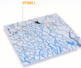 Places with similar names to Uthali, Bangladesh ::
Disclaimer :: Information on this page comes without warranty of any kind |
||
|
Where is Uthali? Elevation and coordinates ::
Latitude (lat): 22°44'0"N Longitude (lon): 89°15'0"E
Elevation (approx.): 12m (map arrows pan, magnifying glasses zoom) |
||
|
Visiting Uthali? Hotel/Accommodation ::
Book a hotel in Uthali Travel Guide ::
Buy a travel guide for Bangladesh rental cars ::
car rental offers GPS waypoint ::
download a GPX waypoint (PoI) of Uthali for your GPS receiver
|
||