|
search place name
|
||
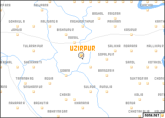
Uzirpur (Barisāl, Bangladesh)Uzirpur is a town in the Barisāl region of Bangladesh. An overview map of the region around Uzirpur is displayed below.
regional and 3d topo map of Uzirpur, Bangladesh ::
Uzirpur airports ::
The nearest airport is JSR - Jessore, located 36.9 km west of Uzirpur.
Other airports nearby include DAC - Dhaka Zia Intl (119.5 km north east), CCU - Calcutta Netaji Subhash Chandra Bose Intl (121.9 km south west), IRD - Ishurdi (122.5 km north west), RJH - Rajshahi Shah Mokhdum (171.1 km north west), Nearby towns ::
Āuria (1.9km north) //
Āterhāt (2.5km south east) //
Narail (4.1km north west) //
Gobra (5.0km south west) //
Gopālpur (5.1km east) //
Bānsgrām (6.3km south east) //
Bishnupur (6.5km north west) //
Raghunāthpur (7.4km north) //
Sulpur (7.6km south) //
Sālikha (7.1km east) //
Purulia (9.0km south east) //
Āgdia (8.8km south west) //
Pāikmāri (10.1km north east) //
Mālidānga (10.1km north west) //
[all distances 'as the bird flies' and approximate] 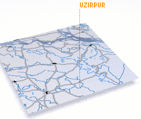 Places with similar names to Uzirpur, Bangladesh ::
Disclaimer :: Information on this page comes without warranty of any kind |
||
|
Where is Uzirpur? Elevation and coordinates ::
Latitude (lat): 23°8'0"N Longitude (lon): 89°31'0"E
Elevation (approx.): 7m (map arrows pan, magnifying glasses zoom) |
||
|
Visiting Uzirpur? Hotel/Accommodation ::
Book a hotel in Uzirpur Travel Guide ::
Buy a travel guide for Bangladesh rental cars ::
car rental offers GPS waypoint ::
download a GPX waypoint (PoI) of Uzirpur for your GPS receiver
|
||