|
search place name
|
||
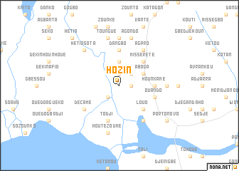
Hozin (Benin)Hozin is a town in Benin. An overview map of the region around Hozin is displayed below.
regional and 3d topo map of Hozin, Benin ::
Hozin airports ::
The nearest airport is COO - Cotonou Cadjehoun, located 26.7 km south west of Hozin.
Other airports nearby include LOS - Lagos Murtala Muhammed (85.4 km east), LFW - Lome Gnassingbe Eyadema Intl (149.0 km west), IBA - Ibadan (182.5 km north east), ILR - Ilorin (300.8 km north east), Nearby towns ::
Vakon (1.8km east) //
Ondji (1.9km north) //
Djigbé (1.8km east) //
Avabodji (2.6km south west) //
Akpamé (2.6km north east) //
Midotokpa (3.7km north) //
Aboga (4.1km north east) //
Louo (5.2km south east) //
Missérété (5.2km north east) //
Dangbo (5.6km north) //
Hounkamé (5.5km east) //
Akonabou (5.8km east) //
Ouando (5.8km east) //
Todji (5.9km south) //
Houédomé (5.9km south) //
Décamé (6.7km south west) //
Adjacin (6.7km south east) //
Agpro (6.7km north east) //
Dogba (7.4km north) //
Adjarra (7.4km east) //
Houtézoumè (7.6km south) //
Agondo (7.6km north) //
Toungué (7.6km north) //
Hétin-Sota (7.8km north west) //
Porto-Novo (9.2km south east) //
Hétin (10.4km north west) //
[all distances 'as the bird flies' and approximate] 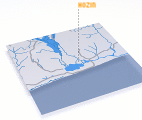 Places with similar names to Hozin, Benin ::
Disclaimer :: Information on this page comes without warranty of any kind |
||
|
Where is Hozin? Elevation and coordinates ::
Latitude (lat): 6°32'0"N Longitude (lon): 2°33'0"E
Elevation (approx.): 4m (map arrows pan, magnifying glasses zoom) |
||
|
Visiting Hozin? Hotel/Accommodation ::
Book a hotel in Hozin Travel Guide ::
Buy a travel guide for Benin rental cars ::
car rental offers GPS waypoint ::
download a GPX waypoint (PoI) of Hozin for your GPS receiver
|
||