|
search place name
|
||
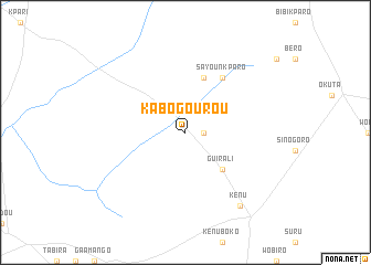
Kabogourou (Benin)Kabogourou is a town in Benin. An overview map of the region around Kabogourou is displayed below.
regional and 3d topo map of Kabogourou, Benin ::
Kabogourou airports ::
The nearest airport is ILR - Ilorin, located 178.9 km south east of Kabogourou.
Other airports nearby include LRL - Niatougou Niamtougou International (224.6 km west), IBA - Ibadan (225.9 km south east), Nearby towns ::
Sammboga (1.8km east) //
Guirali (5.2km south east) //
Malounkoulou (5.9km north) //
Sayounkparo (6.7km north east) //
Kenu (9.2km south east) //
[all distances 'as the bird flies' and approximate] 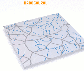 Places with similar names to Kabogourou, Benin ::
// Gubacorr (HU)
// Kaybagar (RU)
// Gbégourou (BJ)
// Gobigourou (BJ)
// Kabagourou (BJ)
// Kabakuro (BI)
// Kabogora (BI)
// Gbagra (CF)
// Kobéguéri (TD)
// Kou Bogri (TD)
Disclaimer :: Information on this page comes without warranty of any kind |
||
|
Where is Kabogourou? Elevation and coordinates ::
Latitude (lat): 9°11'0"N Longitude (lon): 3°3'0"E
Elevation (approx.): 385m (map arrows pan, magnifying glasses zoom) |
||
|
Visiting Kabogourou? Hotel/Accommodation ::
Book a hotel in Kabogourou Travel Guide ::
Buy a travel guide for Benin rental cars ::
car rental offers GPS waypoint ::
download a GPX waypoint (PoI) of Kabogourou for your GPS receiver
|
||