|
search place name
|
||
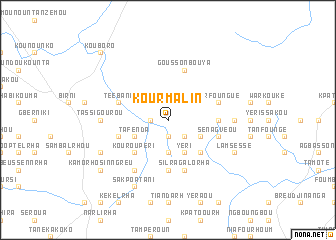
Kourmalin (Benin)Kourmalin is a town in Benin. An overview map of the region around Kourmalin is displayed below.
regional and 3d topo map of Kourmalin, Benin ::
Kourmalin airports ::
The nearest airport is LRL - Niatougou Niamtougou International, located 62.4 km south west of Kourmalin.
Nearby towns ::
Mofir (1.9km south) //
Kpakoumaré (1.8km west) //
Goumourhou-Sinngreu (1.8km west) //
Krotokou (1.9km north) //
Yarhoudorh (1.9km north) //
Fayèlro (2.6km south east) //
Namalkomrha (3.7km south) //
Kpassabia (3.7km south) //
Djéssékou-Sinngreu (4.1km south east) //
Yéri (4.1km south east) //
Djéssékou-Sinngreu (4.1km north east) //
Kolrha (4.1km north east) //
Tafenda (4.1km south west) //
Bonkorou (4.1km north west) //
Sanyèrangou (5.2km south east) //
Dabonkou (5.2km south west) //
Kouroupèri (5.2km south west) //
Sabiyèrimafowa (5.5km east) //
Kamorho-Galorha (5.6km south) //
Foopsoulrha (5.8km west) //
Sénagvéou (5.8km east) //
Goussonbouya (5.9km north) //
Silra-Galorha (5.9km south) //
Téébani (5.8km west) //
Narfoungué (5.8km east) //
Mamazoura (5.8km east) //
Goumourhou-Gpandolou (6.7km south west) //
Garakoursi (7.3km east) //
Tassigourou (7.3km west) //
[all distances 'as the bird flies' and approximate] 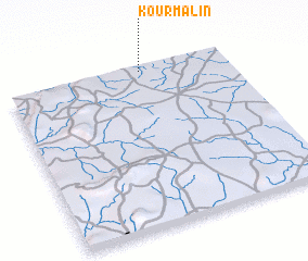 Places with similar names to Kourmalin, Benin ::
// Gremmelin (DE)
// Kremlin (DE)
// Kromolin (PL)
// Kromolin (PL)
// Grimailynė (LT)
// Carmelina (CU)
// Kremlin (US)
// Crum Lynne (US)
// Kremlin (US)
// Karambalana (LK)
Disclaimer :: Information on this page comes without warranty of any kind |
||
|
Where is Kourmalin? Elevation and coordinates ::
Latitude (lat): 9°59'0"N Longitude (lon): 1°37'0"E
Elevation (approx.): 402m (map arrows pan, magnifying glasses zoom) |
||
|
Visiting Kourmalin? Hotel/Accommodation ::
Book a hotel in Kourmalin Travel Guide ::
Buy a travel guide for Benin rental cars ::
car rental offers GPS waypoint ::
download a GPX waypoint (PoI) of Kourmalin for your GPS receiver
|
||