|
search place name
|
||
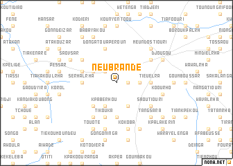
Neubrandé (Benin)Neubrandé is a town in Benin. An overview map of the region around Neubrandé is displayed below.
regional and 3d topo map of Neubrandé, Benin ::
Neubrandé airports ::
The nearest airport is LRL - Niatougou Niamtougou International, located 56.9 km west of Neubrandé.
Nearby towns ::
Sérholrhou (1.8km east) //
Founga (2.6km north west) //
Passar (3.7km east) //
Soubroukou (3.7km east) //
Barei (4.1km north west) //
Kamradour (4.1km south east) //
Kpabérhou (4.1km south west) //
Kambatiouri (5.2km south west) //
Gaho (5.5km east) //
Panienandou (5.5km east) //
Tieuélra (5.5km east) //
Serhalrha (5.5km west) //
Dièrhou (5.6km south) //
Dangoussar (5.8km west) //
Dongatouapèroun (5.9km north) //
Tikouka (5.9km south) //
Térékouka (5.9km south) //
Tioutioulrho (6.6km north east) //
Tamasséka (6.6km north east) //
Neumbakoulra (6.6km north east) //
Tyilirha (6.6km north east) //
Bandéssar (6.6km north west) //
Gooundé (6.7km south west) //
Saoutiouri (6.6km south east) //
Koourho (7.5km east) //
Kokoba (7.6km south) //
Niangre (7.6km south) //
Koutoudyir (7.6km south) //
Meundostiouri (7.8km north east) //
[all distances 'as the bird flies' and approximate] 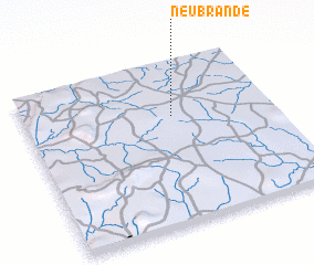 Places with similar names to Neubrandé, Benin ::
Disclaimer :: Information on this page comes without warranty of any kind |
||
|
Where is Neubrandé? Elevation and coordinates ::
Latitude (lat): 9°40'0"N Longitude (lon): 1°36'0"E
Elevation (approx.): 462m (map arrows pan, magnifying glasses zoom) |
||
|
Visiting Neubrandé? Hotel/Accommodation ::
Book a hotel in Neubrandé Travel Guide ::
Buy a travel guide for Benin rental cars ::
car rental offers GPS waypoint ::
download a GPX waypoint (PoI) of Neubrandé for your GPS receiver
|
||