|
search place name
|
||
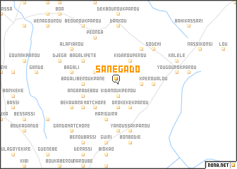
Sanégado (Benin)Sanégado is a town in Benin. An overview map of the region around Sanégado is displayed below.
regional and 3d topo map of Sanégado, Benin ::
Sanégado airports ::
The nearest airport is ILR - Ilorin, located 240.8 km south east of Sanégado.
Nearby towns ::
Kidanoukpérou (1.9km south) //
Bankoubou (3.6km east) //
Arodoro (3.7km south) //
Pessourou (4.1km north west) //
Kidaroupérou (4.1km north east) //
Orokékékparou (4.1km south east) //
Matchoré (5.2km south west) //
Bagalibéroukpané (5.5km west) //
Kpéroualou (5.5km east) //
Angaradebou (5.8km west) //
Mariguira (5.9km south) //
Bagalipété (6.6km north west) //
Bagassi (6.6km north east) //
Agandobaka (6.6km south west) //
Ganouéréré (7.4km south) //
Bagali (7.5km west) //
Yamoussakparou (7.6km south) //
Sodémi (7.8km north east) //
Péonga (8.3km north west) //
Niénessani (8.3km north west) //
Békawara (8.2km south west) //
Alafiarou (9.2km north west) //
Gando Matchoré (10.4km south west) //
[all distances 'as the bird flies' and approximate] 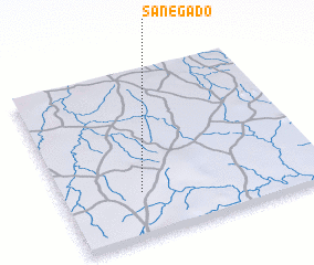 Places with similar names to Sanégado, Benin ::
Disclaimer :: Information on this page comes without warranty of any kind |
||
|
Where is Sanégado? Elevation and coordinates ::
Latitude (lat): 10°16'0"N Longitude (lon): 3°18'0"E
Elevation (approx.): 440m (map arrows pan, magnifying glasses zoom) |
||
|
Visiting Sanégado? Hotel/Accommodation ::
Book a hotel in Sanégado Travel Guide ::
Buy a travel guide for Benin rental cars ::
car rental offers GPS waypoint ::
download a GPX waypoint (PoI) of Sanégado for your GPS receiver
|
||