|
search place name
|
||
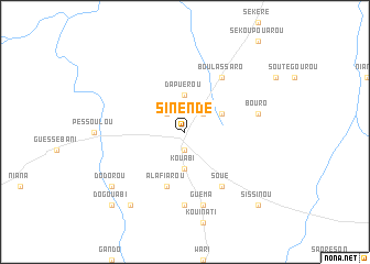
Sinendé (Benin)Sinendé is a town in Benin. An overview map of the region around Sinendé is displayed below.
regional and 3d topo map of Sinendé, Benin ::
Sinendé airports ::
The nearest airport is LRL - Niatougou Niamtougou International, located 155.6 km south west of Sinendé.
Nearby towns ::
Ouhonloupérou (1.9km south) //
Niarougando (2.6km north west) //
Niaro (2.6km north east) //
Kouabi (3.7km south) //
Dapuérou (3.7km north) //
Kouamagouina (4.1km north east) //
Alafiarou (5.9km south) //
Soué (6.6km south east) //
Boulassaro (6.6km north east) //
Dédéa (7.4km south) //
Guéma (7.6km south) //
Boukoro (7.6km south) //
Bouro (7.5km east) //
Dodorou (9.2km south west) //
Angaradéourou (9.2km south west) //
Dogouabi (10.4km south west) //
Sissinou (10.4km south east) //
Kossia (10.4km south east) //
[all distances 'as the bird flies' and approximate] 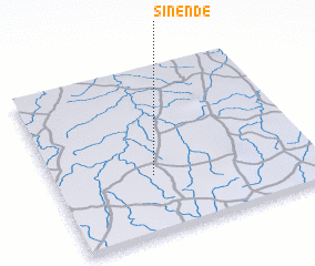 Places with similar names to Sinendé, Benin ::
Disclaimer :: Information on this page comes without warranty of any kind |
||
|
Where is Sinendé? Elevation and coordinates ::
Latitude (lat): 10°21'0"N Longitude (lon): 2°23'0"E
Elevation (approx.): 374m (map arrows pan, magnifying glasses zoom) |
||
|
Visiting Sinendé? Hotel/Accommodation ::
Book a hotel in Sinendé Travel Guide ::
Buy a travel guide for Benin rental cars ::
car rental offers GPS waypoint ::
download a GPX waypoint (PoI) of Sinendé for your GPS receiver
|
||