|
search place name
|
||
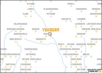
Yovogan (Benin)Yovogan is a town in Benin. An overview map of the region around Yovogan is displayed below.
regional and 3d topo map of Yovogan, Benin ::
Yovogan airports ::
The nearest airport is COO - Cotonou Cadjehoun, located 142.6 km south east of Yovogan.
Other airports nearby include LFW - Lome Gnassingbe Eyadema Intl (150.3 km south), LOS - Lagos Murtala Muhammed (203.5 km south east), ACC - Accra Kotoka Intl (290.3 km south west), Nearby towns ::
Ekpi (1.8km west) //
Gougouta (4.1km south west) //
Tometi (5.2km south east) //
Doussa (5.8km west) //
Batadji (5.8km west) //
Bosou-Akidigba (6.6km south east) //
Pétagba (7.4km north) //
Toukpéta (7.8km north east) //
Gankponzali (7.8km south east) //
Sotone (8.2km south east) //
Tsomanéhoué (9.2km south west) //
Pélékégon (9.2km south east) //
Koukouékamé (9.2km north east) //
Adjanohoué (10.4km south west) //
Katahoué (10.4km south west) //
Agouna Dévé (10.4km north west) //
Akalokoupodji (10.4km south east) //
Kougbadji (10.4km south east) //
Aténougon (10.4km south east) //
[all distances 'as the bird flies' and approximate] 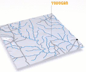 Places with similar names to Yovogan, Benin ::
Disclaimer :: Information on this page comes without warranty of any kind |
||
|
Where is Yovogan? Elevation and coordinates ::
Latitude (lat): 7°27'0"N Longitude (lon): 1°42'0"E
Elevation (approx.): 139m (map arrows pan, magnifying glasses zoom) |
||
|
Visiting Yovogan? Hotel/Accommodation ::
Book a hotel in Yovogan Travel Guide ::
Buy a travel guide for Benin rental cars ::
car rental offers GPS waypoint ::
download a GPX waypoint (PoI) of Yovogan for your GPS receiver
|
||