|
search place name
|
||
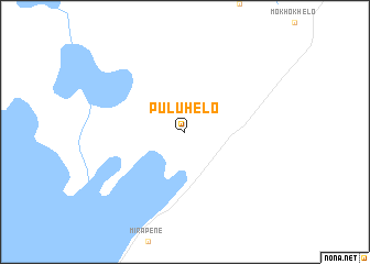
Puluhelo (Botswana)Puluhelo is a town in Botswana. An overview map of the region around Puluhelo is displayed below.
regional and 3d topo map of Puluhelo, Botswana ::
Puluhelo airports ::
The nearest airport is MUB - Maun, located 40.1 km south west of Puluhelo.
Other airports nearby include BBK - Kasane (258.9 km north east), Nearby towns ::
[all distances 'as the bird flies' and approximate]  Places with similar names to Puluhelo, Botswana ::
// Palhal (PT)
// Pill Hill (US)
// Polly Hill (BS)
// Pelahela (LK)
// Palhiāla (PK)
// Palhal (CV)
// Plei Hol (VN)
// Plei Huêlê (VN)
// Plei Halé (VN)
// Pwllheli (GB)
Disclaimer :: Information on this page comes without warranty of any kind |
||
|
Where is Puluhelo? Elevation and coordinates ::
Latitude (lat): 19°42'0"S Longitude (lon): 23°41'0"E
Elevation (approx.): 940m (map arrows pan, magnifying glasses zoom) |
||
|
Visiting Puluhelo? Hotel/Accommodation ::
Book a hotel in Puluhelo Travel Guide ::
Buy a travel guide for Botswana rental cars ::
car rental offers GPS waypoint ::
download a GPX waypoint (PoI) of Puluhelo for your GPS receiver
|
||