|
search place name
|
||
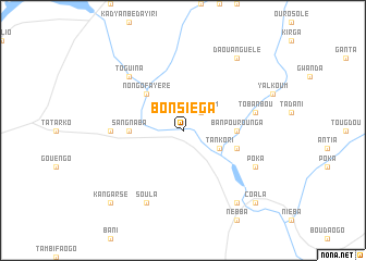
Bonsiéga (Burkina Faso)Bonsiéga is a town in Burkina Faso. An overview map of the region around Bonsiéga is displayed below.
regional and 3d topo map of Bonsiéga, Burkina Faso ::
Bonsiéga airports ::
The nearest airport is OUA - Ouagadougou, located 188.3 km south west of Bonsiéga.
Nearby towns ::
Darsalam (2.6km north east) //
Tankori (4.1km south east) //
Nongo Fayéré (5.2km north west) //
Bouèn Yaga (5.4km west) //
Sang Naba (5.4km west) //
Banpourounga (5.4km east) //
Kouroukida (5.7km east) //
Koulou Ganda (7.2km west) //
Tobanbou (7.4km east) //
Dyagourgadé (7.4km east) //
Toguina (7.8km north west) //
Soula (8.2km south west) //
Poka (8.1km south east) //
Daouanguèlé (9.2km north east) //
Banbigouabri (9.2km south east) //
Tindonoui (9.2km south east) //
Kangarsé (10.3km south west) //
Coala (10.3km south east) //
[all distances 'as the bird flies' and approximate] 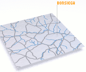 Places with similar names to Bonsiéga, Burkina Faso ::
// Bansag (PH)
// Bünsche (DE)
// Ban Na Sak (TH)
// Ban Na Sok (TH)
// Ban Na Sok (TH)
// Ban Na Sok (TH)
// Ban Na Sok (TH)
// Ban Sa Kae (TH)
// Ban Sakae (TH)
// Ban Sakae (TH)
Disclaimer :: Information on this page comes without warranty of any kind |
||
|
Where is Bonsiéga? Elevation and coordinates ::
Latitude (lat): 13°28'0"N Longitude (lon): 0°12'0"W
Elevation (approx.): 264m (map arrows pan, magnifying glasses zoom) |
||
|
Visiting Bonsiéga? Hotel/Accommodation ::
Book a hotel in Bonsiéga Travel Guide ::
rental cars ::
car rental offers GPS waypoint ::
download a GPX waypoint (PoI) of Bonsiéga for your GPS receiver
|
||