|
search place name
|
||
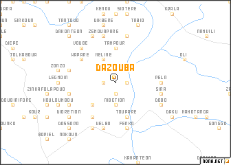
Dazouba (Burkina Faso)Dazouba is a town in Burkina Faso. An overview map of the region around Dazouba is displayed below.
regional and 3d topo map of Dazouba, Burkina Faso ::
Dazouba airports ::
The nearest airport is BOY - Bobo-dioulasso Bobo Dioulasso, located 199.8 km north west of Dazouba.
Other airports nearby include TML - Tamale (224.1 km east), Nearby towns ::
Kpala (1.8km west) //
Paliho (1.8km east) //
Tobil (1.9km south) //
Tiékel (2.6km north west) //
Piri (2.6km north west) //
Nibétion (3.7km south) //
Mélime (4.1km north west) //
Dakpolo Tanzou (5.2km south west) //
Selaba (5.6km north) //
Tampour (5.6km north) //
Toupare (5.9km south) //
Wapare (6.6km north west) //
Dankana (6.7km south west) //
Murathu (7.3km east) //
Pela (7.3km east) //
Doutonblé (7.5km west) //
Siloum (7.5km west) //
Zémouapare (7.6km north) //
Wadiel (7.6km south) //
Welba (7.6km south) //
Kouzié (7.6km north) //
Sira (7.5km east) //
Ferka (7.6km south) //
Voubé (7.8km north west) //
Doutome (8.2km south west) //
Tobo (8.3km north west) //
Dobo (8.2km south east) //
Kolibié (8.3km south west) //
Diorétion (9.2km south west) //
[all distances 'as the bird flies' and approximate] 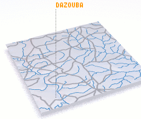 Places with similar names to Dazouba, Burkina Faso ::
Disclaimer :: Information on this page comes without warranty of any kind |
||
|
Where is Dazouba? Elevation and coordinates ::
Latitude (lat): 10°9'0"N Longitude (lon): 2°49'0"W
Elevation (approx.): 256m (map arrows pan, magnifying glasses zoom) |
||
|
Visiting Dazouba? Hotel/Accommodation ::
Book a hotel in Dazouba Travel Guide ::
rental cars ::
car rental offers GPS waypoint ::
download a GPX waypoint (PoI) of Dazouba for your GPS receiver
|
||