|
search place name
|
||
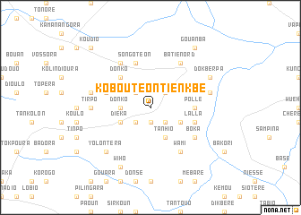
Koboutéon Tienkbé (Burkina Faso)Koboutéon Tienkbé is a town in Burkina Faso. An overview map of the region around Koboutéon Tienkbé is displayed below.
regional and 3d topo map of Koboutéon Tienkbé, Burkina Faso ::
Koboutéon Tienkbé airports ::
The nearest airport is BOY - Bobo-dioulasso Bobo Dioulasso, located 178.8 km north west of Koboutéon Tienkbé.
Nearby towns ::
Sona (1.9km south) //
Gongon (2.6km south west) //
Tanbili (2.6km south west) //
Somatéon (2.6km north west) //
Kankani (2.6km north east) //
Sonpar (2.6km south east) //
Donko (3.6km west) //
Tanhio (4.1km south east) //
Diéka (4.1km south west) //
Batié Blé (4.1km south west) //
Gankoula (4.1km south east) //
Donko (5.2km north west) //
Pollé (5.5km east) //
Songotéon (5.9km north) //
Lalla (5.8km east) //
Kpo (5.8km west) //
Boka (6.6km south east) //
Lemmka (6.6km north west) //
Wami (6.6km south east) //
Batié Nord (6.6km north east) //
Tirpo (7.3km west) //
Gbara (7.5km west) //
Goumparé (7.5km east) //
Yolontéra (7.8km south west) //
Wiho (8.3km south west) //
Dokberpa (8.2km north east) //
Gouanba (9.2km north east) //
Koudio (10.4km north west) //
[all distances 'as the bird flies' and approximate] 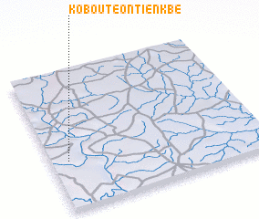 Places with similar names to Koboutéon Tienkbé, Burkina Faso :: Disclaimer :: Information on this page comes without warranty of any kind |
||
|
Where is Koboutéon Tienkbé? Elevation and coordinates ::
Latitude (lat): 10°21'0"N Longitude (lon): 2°55'0"W
Elevation (approx.): 270m (map arrows pan, magnifying glasses zoom) |
||
|
Visiting Koboutéon Tienkbé? Hotel/Accommodation ::
Book a hotel in Koboutéon Tienkbé Travel Guide ::
rental cars ::
car rental offers GPS waypoint ::
download a GPX waypoint (PoI) of Koboutéon Tienkbé for your GPS receiver
|
||