|
search place name
|
||
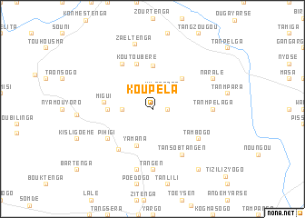
Koupéla (Burkina Faso)Koupéla is a town in Burkina Faso. An overview map of the region around Koupéla is displayed below.
regional and 3d topo map of Koupéla, Burkina Faso ::
Koupéla airports ::
The nearest airport is OUA - Ouagadougou, located 59.6 km south west of Koupéla.
Nearby towns ::
Goudri (1.8km east) //
Yilatenga (2.5km north east) //
Ipala (2.6km north west) //
Nigui (3.6km west) //
Yamana (4.8km south west) //
Napamboumbou (5.2km north east) //
Yimyougou (5.4km north) //
Kounla (5.4km west) //
Koutoubéré (5.8km north) //
Migui (5.8km west) //
Sadaba (6.4km south west) //
Tansobtangen (6.6km south east) //
Tambogo (6.6km south east) //
Pihigi (6.6km south west) //
Koutoberlé (6.6km north west) //
Tangen (7.4km south) //
Tanmpélaga (7.2km east) //
Nartaoli (7.6km south) //
Zaèltenga (8.2km north) //
Naralé (8.1km north east) //
Samtenga (9.2km south east) //
[all distances 'as the bird flies' and approximate] 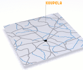 Places with similar names to Koupéla, Burkina Faso ::
Disclaimer :: Information on this page comes without warranty of any kind |
||
|
Where is Koupéla? Elevation and coordinates ::
Latitude (lat): 12°51'0"N Longitude (lon): 1°18'0"W
Elevation (approx.): 334m (map arrows pan, magnifying glasses zoom) |
||
|
Visiting Koupéla? Hotel/Accommodation ::
Book a hotel in Koupéla Travel Guide ::
rental cars ::
car rental offers GPS waypoint ::
download a GPX waypoint (PoI) of Koupéla for your GPS receiver
|
||