|
search place name
|
||
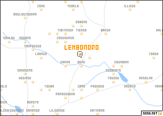
Lèmbonoro (Burkina Faso)Lèmbonoro is a town in Burkina Faso. An overview map of the region around Lèmbonoro is displayed below.
regional and 3d topo map of Lèmbonoro, Burkina Faso ::
Lèmbonoro airports ::
The nearest airport is OUA - Ouagadougou, located 175.8 km south east of Lèmbonoro.
Other airports nearby include MZI - Mopti Ambodedjo (209.0 km north west), Nearby towns ::
Bèné (1.9km south) //
Kammbondogué (1.8km east) //
Ramdolla (2.6km north east) //
Karma (4.0km south west) //
Ipala (5.2km north west) //
Zoudounga (5.2km north west) //
Tierga (5.6km north) //
Tibitenga (6.6km north west) //
Dinguiri (6.6km north west) //
Toroué (6.6km north west) //
Zano (7.4km south) //
Sobono (7.4km north) //
Aoréama (7.6km south) //
Kaléhéna (7.4km east) //
Derfogo (7.6km north) //
Barga (7.8km north east) //
Kilissimoko (7.8km north west) //
Faogodo (8.2km south east) //
Sénokayé (8.1km south east) //
Kougoularé (9.1km north west) //
Tougou (9.1km south east) //
Youba (10.3km south west) //
[all distances 'as the bird flies' and approximate] 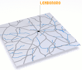 Places with similar names to Lèmbonoro, Burkina Faso ::
Disclaimer :: Information on this page comes without warranty of any kind |
||
|
Where is Lèmbonoro? Elevation and coordinates ::
Latitude (lat): 13°44'0"N Longitude (lon): 2°19'0"W
Elevation (approx.): 338m (map arrows pan, magnifying glasses zoom) |
||
|
Visiting Lèmbonoro? Hotel/Accommodation ::
Book a hotel in Lèmbonoro Travel Guide ::
rental cars ::
car rental offers GPS waypoint ::
download a GPX waypoint (PoI) of Lèmbonoro for your GPS receiver
|
||