|
search place name
|
||
Liligondé (Burkina Faso)Liligondé is a town in Burkina Faso. An overview map of the region around Liligondé is displayed below.
regional and 3d topo map of Liligondé, Burkina Faso ::

Liligondé airports ::
The nearest airport is OUA - Ouagadougou, located 167.7 km south east of Liligondé.
Other airports nearby include MZI - Mopti Ambodedjo (209.9 km north west), Nearby towns ::
Rapougouma (4.1km north east) //
Baghélogo (5.2km south east) //
Sananga (5.4km west) //
Gourga (5.8km south) //
Boroya (5.7km west) //
Youba (5.8km north) //
Kononga (5.7km east) //
Yabonso (6.6km north west) //
Bassénéré (6.6km north east) //
Ouahigouya (6.6km south west) //
Aoréama (6.6km north east) //
Sinofoussé (7.4km west) //
Nongo (7.4km east) //
Zano (7.8km north east) //
Nogo (8.2km south east) //
Sihissène (9.2km north west) //
Oufré (9.2km south west) //
Wédinsé (10.3km north west) //
Fourouma (10.3km south west) //
[all distances 'as the bird flies' and approximate] 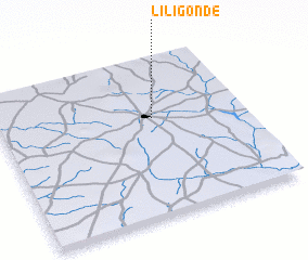 Places with similar names to Liligondé, Burkina Faso ::
// Lilkendey (DE)
// La Lagunita (PA)
// Luli Kāndi (BD)
// Liligonndé (BF)
// La Lagunita (CO)
// La Lagunita (CO)
// Lolekunda (CD)
// La Laguneta (SV)
// La Laguneta (SV)
// La Laguneta (GT)
Disclaimer :: Information on this page comes without warranty of any kind |
||
|
Where is Liligondé? Elevation and coordinates ::
Latitude (lat): 13°37'0"N Longitude (lon): 2°22'0"W
Elevation (approx.): 320m (map arrows pan, magnifying glasses zoom) |
||
|
Visiting Liligondé? Hotel/Accommodation ::
Book a hotel in Liligondé Travel Guide ::
rental cars ::
car rental offers GPS waypoint ::
download a GPX waypoint (PoI) of Liligondé for your GPS receiver
|
||