|
search place name
|
||
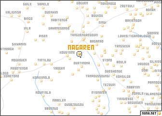
Nagaren (Kadiogo, Burkina Faso)Nagaren is a town in the Kadiogo region of Burkina Faso. An overview map of the region around Nagaren is displayed below.
regional and 3d topo map of Nagaren, Burkina Faso ::
Nagaren airports ::
The nearest airport is OUA - Ouagadougou, located 26.6 km north east of Nagaren.
Nearby towns ::
Goguen (1.0km north) //
Ouatinoma (2.1km south) //
Siguinvoussé (2.5km north east) //
Taonsogo (2.5km west) //
Lao (2.9km south) //
Koudyéré (3.1km west) //
Baoguen (3.3km east) //
Itaoua (4.2km north) //
Samben (4.2km south west) //
Komléla (4.3km north west) //
Sogué (4.4km south east) //
Tanguen-Dassouri (4.5km north) //
Bagarao (4.7km north east) //
Zambanaga (4.7km east) //
Woumtenga (5.6km east) //
Bissigui (5.6km east) //
Yaogen (5.9km south west) //
Kolognaba (6.0km north) //
Syoro (6.2km east) //
Tampoussoumdi (6.4km south east) //
Bouli (6.5km north) //
Nédogo (6.8km north east) //
Ouédégen (6.8km west) //
Ouégléga (7.3km north) //
Kankanguen (7.2km east) //
Lougoubissi (7.6km east) //
Dawanégomdé (7.7km north west) //
Balolé (7.9km north) //
Louksi (8.1km east) //
[all distances 'as the bird flies' and approximate] 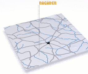 Places with similar names to Nagaren, Burkina Faso ::
// Neugrün (DE)
// Neugrün (DE)
// Neu Göhren (DE)
// Neu Karin (DE)
// Neu Krien (DE)
// Néa Koróni (GR)
// Nekrūnai (LT)
// Negrín (CU)
// Negreni (RO)
// Negreni (RO)
Disclaimer :: Information on this page comes without warranty of any kind |
||
|
Where is Nagaren? Elevation and coordinates ::
Latitude (lat): 12°13'46"N Longitude (lon): 1°43'19"W
Elevation (approx.): 346m (map arrows pan, magnifying glasses zoom) |
||
|
Visiting Nagaren? Hotel/Accommodation ::
Book a hotel in Nagaren Travel Guide ::
rental cars ::
car rental offers GPS waypoint ::
download a GPX waypoint (PoI) of Nagaren for your GPS receiver
|
||