|
search place name
|
||
Nèssèmtenga (Burkina Faso)Nèssèmtenga is a town in Burkina Faso. An overview map of the region around Nèssèmtenga is displayed below.
regional and 3d topo map of Nèssèmtenga, Burkina Faso ::

Nèssèmtenga airports ::
The nearest airport is OUA - Ouagadougou, located 83.3 km south west of Nèssèmtenga.
Nearby towns ::
Nésémtenga (1.9km south) //
Liligonndé (1.8km west) //
Birgui (2.6km north east) //
Bingo (2.6km south east) //
Bisigui Yolgo (3.7km south) //
Pousmiougou (4.1km north east) //
Foutrigui (4.1km north west) //
Goragi (4.1km north east) //
Pousgo (4.1km north east) //
Goungué Yolgo (4.1km south east) //
Gwahala (4.1km south west) //
Louda (5.4km east) //
Niogossé (5.4km east) //
Zanzi (5.4km west) //
Zanvi (5.6km south) //
Siguinvousé (5.8km north) //
Gantodro (5.8km north) //
Tanpèlga (6.6km north east) //
Soroden (6.6km north west) //
Zérédéguen (7.4km north) //
Toéssé (7.5km east) //
Birgui (7.6km south) //
Biguissi (7.6km south) //
Lélèguéssé (7.8km north east) //
Gouli (7.8km south west) //
Tiouéga (8.2km north east) //
Bèotenga (8.1km north east) //
Moké Linoré (8.1km south east) //
Goulouguen (9.2km north west) //
[all distances 'as the bird flies' and approximate] 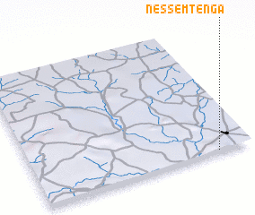 Places with similar names to Nèssèmtenga, Burkina Faso ::
// Nésémtenga (BF)
Disclaimer :: Information on this page comes without warranty of any kind |
||
|
Where is Nèssèmtenga? Elevation and coordinates ::
Latitude (lat): 13°1'0"N Longitude (lon): 1°9'0"W
Elevation (approx.): 345m (map arrows pan, magnifying glasses zoom) |
||
|
Visiting Nèssèmtenga? Hotel/Accommodation ::
Book a hotel in Nèssèmtenga Travel Guide ::
rental cars ::
car rental offers GPS waypoint ::
download a GPX waypoint (PoI) of Nèssèmtenga for your GPS receiver
|
||