|
search place name
|
||
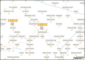
Sabsé (Burkina Faso)Sabsé is a town in Burkina Faso. An overview map of the region around Sabsé is displayed below.
regional and 3d topo map of Sabsé, Burkina Faso ::
Sabsé airports ::
The nearest airport is OUA - Ouagadougou, located 99.5 km west of Sabsé.
Nearby towns ::
Tandaga (1.8km east) //
Ouavoussé (1.9km south) //
Tyèrsoum (1.8km west) //
Gada (2.6km south west) //
Karé (3.7km south) //
Kologo Sama (3.7km south) //
Siguinoguen (4.1km north west) //
Pouèssen (4.1km north west) //
Sabtenga (5.2km north east) //
Salogho (5.2km north west) //
Tamansongo (5.2km south west) //
Ouapassé (5.8km south) //
Nabitenga (6.6km north east) //
Naoubé (6.6km north west) //
Tiguendélga (6.6km south east) //
Ipala (6.6km south west) //
Kodemendé (7.4km north) //
Bissiga (7.5km east) //
Tansahélogo (7.8km north west) //
Binogo (7.8km south west) //
Napalré (8.3km south east) //
Kongoussen (8.3km south east) //
Koumsyéogo (8.1km south east) //
Koulogo (8.1km south west) //
Mobéga (9.1km north east) //
Temnoré (9.1km south east) //
Tanguen (9.2km south west) //
Nyèmné (10.4km north west) //
[all distances 'as the bird flies' and approximate] 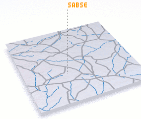 Places with similar names to Sabsé, Burkina Faso ::
Disclaimer :: Information on this page comes without warranty of any kind |
||
|
Where is Sabsé? Elevation and coordinates ::
Latitude (lat): 12°25'0"N Longitude (lon): 0°36'0"W
Elevation (approx.): 310m (map arrows pan, magnifying glasses zoom) |
||
|
Visiting Sabsé? Hotel/Accommodation ::
Book a hotel in Sabsé Travel Guide ::
rental cars ::
car rental offers GPS waypoint ::
download a GPX waypoint (PoI) of Sabsé for your GPS receiver
|
||