|
search place name
|
||
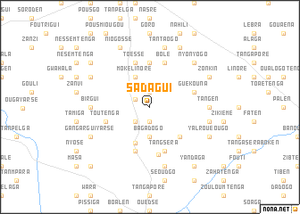
Sadagui (Burkina Faso)Sadagui is a town in Burkina Faso. An overview map of the region around Sadagui is displayed below.
regional and 3d topo map of Sadagui, Burkina Faso ::
Sadagui airports ::
The nearest airport is OUA - Ouagadougou, located 81.9 km south west of Sadagui.
Nearby towns ::
Tandouka (1.9km south) //
Santéna (1.9km north) //
Séra (1.9km north) //
Toysé (2.0km north west) //
Wiréha (2.6km south west) //
Bagadogo (3.7km south) //
Moké Linoré (4.1km north west) //
Boussouma (4.8km south) //
Gouromo (5.2km south east) //
Guila (5.2km south east) //
Bisnogo (5.6km north) //
Tandaga (5.8km south) //
Toéssé (5.8km north) //
Tangséra (5.8km south) //
Toutenga (5.7km west) //
Guékouna (5.7km east) //
Boulsi (5.7km east) //
Bolé (5.8km north) //
Noré (6.0km south) //
Birgui (7.2km west) //
Biguissi (7.2km west) //
Tangen (7.2km east) //
Baralé (7.6km south) //
Silmisi (7.5km east) //
Tantaogo (7.6km north) //
Nyonyogo (7.8km north east) //
Gangargui (8.1km south west) //
Gangargui Yarsé (8.1km south west) //
Goungué Yolgo (8.1km north west) //
[all distances 'as the bird flies' and approximate] 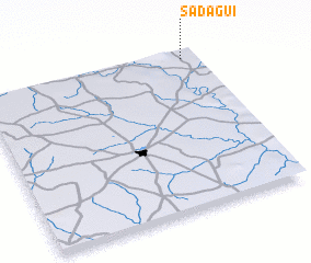 Places with similar names to Sadagui, Burkina Faso ::
Disclaimer :: Information on this page comes without warranty of any kind |
||
|
Where is Sadagui? Elevation and coordinates ::
Latitude (lat): 12°57'0"N Longitude (lon): 1°4'0"W
Elevation (approx.): 304m (map arrows pan, magnifying glasses zoom) |
||
|
Visiting Sadagui? Hotel/Accommodation ::
Book a hotel in Sadagui Travel Guide ::
rental cars ::
car rental offers GPS waypoint ::
download a GPX waypoint (PoI) of Sadagui for your GPS receiver
|
||