|
search place name
|
||
Siktéon (Burkina Faso)Siktéon is a town in Burkina Faso. An overview map of the region around Siktéon is displayed below.
regional and 3d topo map of Siktéon, Burkina Faso ::

Siktéon airports ::
The nearest airport is BOY - Bobo-dioulasso Bobo Dioulasso, located 155.9 km west of Siktéon.
Other airports nearby include OUA - Ouagadougou (243.3 km north east), Nearby towns ::
Niagma (1.9km north) //
Bélarkaré (2.6km north east) //
Soum (4.1km south east) //
Hemkoa (4.1km south west) //
Babié (4.1km south west) //
Koulougbélé (4.1km south west) //
Tanbili (4.1km north west) //
Boukéro (5.2km south east) //
Manoa (5.2km north east) //
Tielka (5.2km south west) //
Bélé (5.6km south) //
Irkou (5.5km west) //
Lokono (5.9km south) //
Boumboulou (5.9km south) //
Pissin (6.6km south east) //
Gorougbé (6.6km south east) //
Boulinbé (6.6km south west) //
Yépéla (6.6km south west) //
Attoum (7.4km south) //
Dolochi (7.6km south) //
Bonko (7.6km north) //
Kondié (7.8km south west) //
Sinsiriko (8.2km south west) //
Sando (8.3km south west) //
Diangara (8.3km south west) //
Nakui (10.4km north east) //
[all distances 'as the bird flies' and approximate] 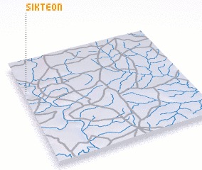 Places with similar names to Siktéon, Burkina Faso ::
// Souktana (MA)
// São Caetano (BR)
// São Caetano (BR)
// São Caetano (BR)
// São Caetano (BR)
// São Caetano (BR)
// São Caetano (BR)
// São Caetano (BR)
// São Caetano (BR)
// São Caetano (BR)
Disclaimer :: Information on this page comes without warranty of any kind |
||
|
Where is Siktéon? Elevation and coordinates ::
Latitude (lat): 10°42'0"N Longitude (lon): 2°59'0"W
Elevation (approx.): 259m (map arrows pan, magnifying glasses zoom) |
||
|
Visiting Siktéon? Hotel/Accommodation ::
Book a hotel in Siktéon Travel Guide ::
rental cars ::
car rental offers GPS waypoint ::
download a GPX waypoint (PoI) of Siktéon for your GPS receiver
|
||